Documents,
Charts, Architectural Plans, Maps, etc.
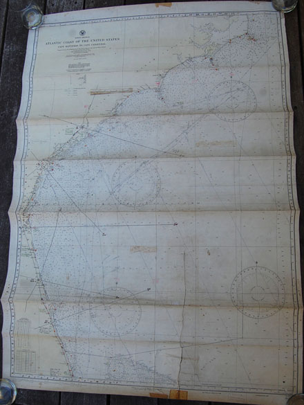
16181.
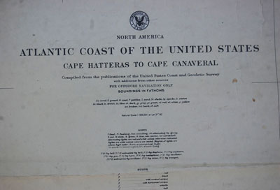
[chart]. Atlantic Coast of the United States - Cape
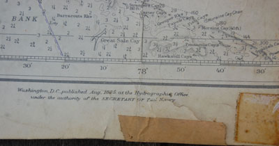
Hatteras to Cape Canaveral #903. United States Coast and Geodetic
Survey. August 1885. 115th Edition Feb 1934, corrected through 1939 by Notice to
Mariners. Scale 1:835,591. Original detailed 4-color chart measures 34” x
49” and includes all of the coastline from Chicamacomico and Cape Hatteras
south to Jupiter Inlet, Florida. Chart includes all Coast Guard Lifeboat
stations as well as all lighthouses, buoys, towns and features and more. The
area has numerous shoals and bars, and the entire area is exceedingly
treacherous. Included on the chart are bearings and soundings. Chart has been
well used and includes navigator’s course markings with many notations. Chart
is intact except for one 16” tear from bottom that has old tape repair on the
back. Overall light to moderate soiling, a few small stains. Would make a very
interesting wall decoration. Rolled but with some early folds as well. Notations
indicate that this chart was used on some type of patrol vessel, likely during
WWII. Chart is from the estate of Navy Rear Admiral Irwin Chase Jr.(1911-2001).
Admiral Chase served in the Pacific theater during WWII under Admiral Halsey and
was awarded the Silver Star. During WWII he was assigned to the Fast Attack
Carrier Ticonderoga as Navigator. On January 21, 1945 the Ticonderoga was
attacked by kamikaze planes near Formosa and with the Captain & Executive
officer wounded, then commander Chase, took command and led the ship through
fire fighting and damage control and brought the ship back to her base at Ulithi.
He was also present in Tokyo Bay on the USS Missouri when Japan formally
surrendered to General MacArthur and Admiral Nimitz. In1957 he returned to
command the Ticonderoga for a Far Eastern Cruise to Japan, the Philippines, Hong
Kong and Okinawa. He retired from the Navy in 1959. (P+). $58.

16151.
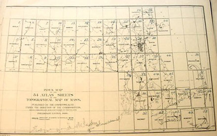
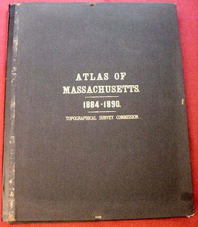
(topographic maps) Sheet. Atlas
Of Massachusetts 1884-1890. Topographical Survey Commission ~ U.S.
Geological Survey - Commissioners of the Commonwealth. Francis A. Walker, Henry
L. Whiting, N.S. Shaler~ Commissioners. Size 18” x 24” each. From early
Atlas of Massachusetts. Beautiful, early, multi-color topographic maps show the
important contours and features of the area including the Lighthouses and
Life-Saving Stations, light vessels, as well as roads and important town
buildings, etc. Each map includes the town mentioned with surrounding towns or
portions thereof. Also includes all roads, railway lines, shoals and bars,
lakes, rivers and other topographic features, and much more. Maps are quite
desirable for framing and are as original. Pick your hometown or favorite area.
Unusually clean and crisp. These early coastal and area maps are most desirable
for display and bring a premium, particularly on the
Cape
and the islands. (VG+).
The
54 Atlas Sheets available individually include: 1. Berlin Sheet. $12; (2).
Pittsfield Sheet. $12; (3). Sheffield Sheet. $12; (5).
Becket Sheet. $12; (7). Hawley Sheet. $12; (8).
Chesterfield Sheet. $12; (9). Granville Sheet. $12; (10). Greenfield Sheet. $12;
(11). Northampton Sheet. $12; (13). Warwick Sheet.
$12; (14). Belchertown Sheet. $12; (15). Palmer Sheet. $12; (16). Winchendon
Sheet. $12; (17). Barre Sheet. $12; (18). Brookfield Sheet. $12; (19). Fitchburg
Sheet. $12; (20). Worcester Sheet. $12; (21). Webster Sheet. $12; (22). Groton
Sheet. $12; (24). Blackstone Sheet. $12; (25). Lowell
Sheet. $12; (26). Framingham Sheet. $12; (27). Franklin Sheet. $12; (28).
Providence Sheet. $12; (29). Haverhill Sheet. $12; (30). Lawrence Sheet. $12;
(32). Dedham Sheet. $12; (33). Taunton Sheet.
$12; (34). Fall River Sheet. $12; (35). Sakonnet Sheet. $12; (39). Abington Sheet. $12; (40). Middleborough Sheet. $12; (41). New Bedford
Sheet. $18; (49). Muskeget Sheet.
$12; (53). Nantucket Sheet. $48;
16197a.
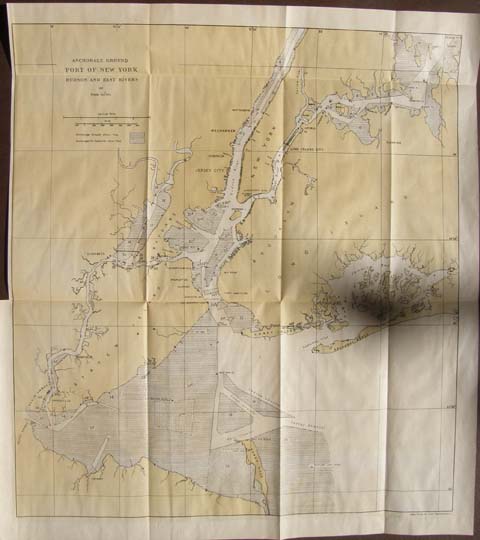
(map) Anchorage Ground Port of New York Hudson and East
Rivers. Coast and Geodetic Survey. c.1918-1926. Wash. 18” x 16”
Three color. Good detail of the area including anchorages, towns, etc. Light
original folds but will frame well. Includes written descriptions from Coast
Pilot. (VG+). $14.
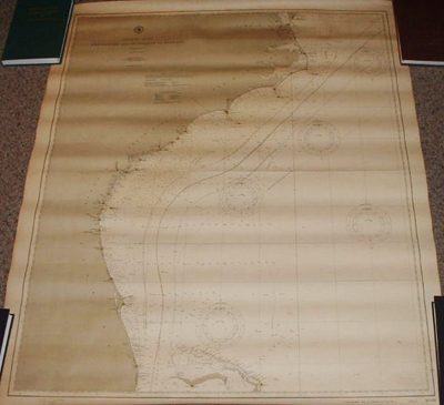
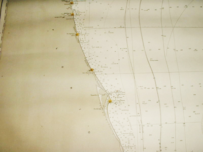
12214. (lighthouse chart) "ATLANTIC
COAST, CHESAPEAKE BAY TO STRAITS OF FLORIDA". Chart #1001. June 1904 Edition
of the original 1900 chart. United States Coast And Geodetic Survey. Washington,
DC. Stamp on the bottom left which notes that light houses have been corrected
to 1911. Measures 36" wide by 44" high. Covers the coastline from
Chesapeake Bay south to and West Palm Beach. Also covers a few of the
northern Bahama Islands including different tracts of the Gulf Stream. Coastal
lighthouses are highlighted in yellow, approach buoys in red. Includes inlets,
towns and cities along the coast, coastal sounding, currents and more. Quite a
nice chart representing the light stations along this stretch of coastline and
not to “busy” to overshadow them. Unusually clean, intact, no tears, perfect
for framing. (VG+). $140.
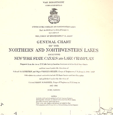
12100. (chart) General
Chart of the Northern and Northwestern Lakes Including New York State Canals and
Lake Champlain. War Department. Corps. Of Engineers. 1915-1916. Scale
1: 1,200,000. 15 ½” x 24”. Original printed paper, with original folds.
Includes cities and towns, most lighthouses and other important locations.
Clean, crisp, no tears. Although a lot of information, very small print, still
would be a striking Great Lakes piece framed. (VG+). $114.
23368b.
[lot] Lorenzo Sitgreaves (ca. 1811-1888) –
U. S.
Lighthouse Engineer, Surveyor and topographical engineer.
During
the Mexican War Lorenzo Sitgreaves took part in the Battle of Buena Vista
and marched through Chihuahua, he led an 1851 Zuni and Colorado Rivers
survey expedition and for many years after was assigned to the Light House
Establishment and involved in the construction and repair of many of the
nation’s light stations. His career with the Light House Establishment
involved work on numerous light stations on the Atlantic and Great Lakes
coasts and his work can still be seen in hundreds of locations including
the 1858 Bodie Island Lighthouse, Cape Charles LH, La Pointe Lighthouse on
the southern shore of Lake Superior, and hundreds more. In addition, he
was in charge, Office of Lighthouse Engineer, at
Detroit
December 21, 1852, to December 11, 1856. During the Civil War, Sitgreaves
attained the rank of lieutenant colonel in the Corps of Engineers.
Sitgreaves conducted the first scientific expedition across
Arizona
in the early 1850’s and later the
Apache
Sitgreaves
National Forest
in
New Mexico
and
Arizona
was named for him. This rare lot from his personal files contains numerous
items and information chronicling his work during the 1850-60’s.
Included are:
1. Civil War era check register maintained by Major Lorenzo Sitgreaves,
6" x 8.25", marigold paper cover, handwritten on front, "Ist
National Bank,
Madison
,
Wis
, 1864, Aug. 3 to Oct. 22". 55pp. used -- appx. 162 checks. Some of
the names: Lieut. A Rood; Maj. G. R. Giddings; Maj. N. Richardson; Capt.
Wm. C. Young; Lieut. J. H. Purcell; Col. C. S. Lovell and more, and many
non-officers. Payment notations include: transport; rent; rations;
stationary; lodging; telegrams, "services clerk
Camp
Randall
." Unsigned by Sitgreaves, though he possibly wrote his name on one
of the checks. Also included is similar bankbook in account with
Maj. Sitgreaves.
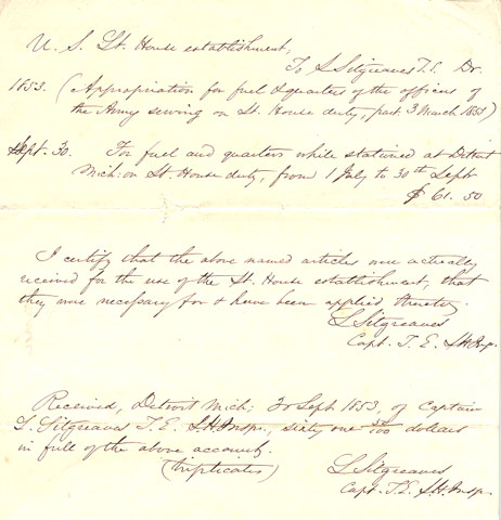
2. U. S. Lighthouse Establishment, manuscript invoice/receipt, 1p.,
8" x 10", Sept. 1853, ADS signed three times, "L.
Sitgreaves" Capt. T.E. L.H. Insp. Top notes that Sitgreaves is owed
and appropriation of $61.50 "For fuel & quarters of the officers
of the Army serving on Lt. House duty - 3 March 1853" and "For
fuel and quarters while stationed at Detroit Mich on Lt. House duty, from
1 July to 30th Sept". Sitgreaves then certifies that the above was
for Lt. House use and then notes that he received payment on 30 Sept.
1853.
3. Original Survey Notes [in hand of Lorenzo Sitgreaves]. Two manuscripts:
1. 3 1/2pp., 8" x 10", Aug. 3, 1851, ink on blue paper. Reads,
"Method used in making observations for azimuth at [delta shape]
Mt. Pleasant
,
U. S.
Coast Survey" and "Result of observation for azimuth before and
after culmination." Appx. two pages of text, one page chart and one
and half pages of keys/formulas. The text notes, "The elongation mark
used in the observations was placed almost exactly in line to
Mt.
Blue
, on the summit of the next ridge of the mountains about a mile distant
from the station." Quite esoteric, however was written in the same
year that Sitgreaves led his noted survey expedition. Fine condition.
4. Mexican War Surveyor's Receipt - 1p., 7.75" x 9.75", Feb. 6,
1847,
Saltillo
,
Mexico
, signed "Dan Drake Henrie". [Note: The Battle of Buena Vista
took place a little south of
Saltillo
on Feb. 23, 1847 Sitgreaves was engaged in this battle and was breveted
captain for bravery.] Daniel "Dan" Drake Henrie (b. 1824), a
Mormon from
Nauvoo
,
IL
, joined the Mormon Battalion in 1846. He was a noted government surveyor
who participated in the surveying of the Mason Dixon line. In Sitgreaves
hand, the receipt notes that Henrie was due $50.60, "To Services as
assistant surveyor from the 1st to the 23rd Dec 1846, being 23 days at
$2.00 pr. day" and one ration per day at 20 cts per ration. Henrie
signs below noting that he received payment from Lieut. L. Sitgreaves T.
Engr. Although the bottom of the page notes, "Duplicate" the
signature of Henrie is not in Sitgreaves' hand. This is probably a second
copy for Sitgreaves' records. One 2" split, well away from text, and
a few edge nicks, otherwise excellent condition
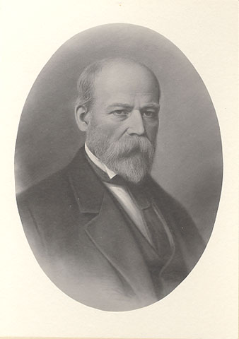
5. Mixed assortment of items – fine gravure cabinet style portrait
photo, possibly Sitgreaves in his later years; retirement papers; letter
to Sitgreaves at age three from his aunt; billheads; original 1888 will
leaving his goods to Ms Mary Jesup Sitgreaves; 1878 hand written last
will; published will of brother Theodore R. Sitgreaves; 1882 letter
from brother; misc. letters/papers. Appx. 25 items.
An important lot relating to this noted lighthouse engineer. $585. Reduced
$465.
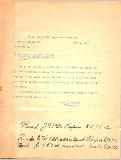
11469. (document) U.S.
Lighthouse Service, Twelfth Lighthouse District c.1913. Original
typed letter from the Office of the Twelfth Lighthouse District Inspector Lewis
M. Stoddard dated July 2, 1913, titled “District Circular # 25 Fuel Supply to
all keepers of Light Stations with fog signals operated by steam.” The letter
was apparently given to three keepers who wrote the words “Read" and
initialed it. However, we have no idea of the names of the keepers. The
keeper’s initials are JPB for the Principal Keeper, EH for the 1st Assistant
and JKF for the 2nd Assistant keeper. The inspector notes that it is the
intention of the Lighthouse Service to deliver fog signal fuel by tender
whenever possible, and directs the keepers to notify the District office when
the fuel supply gets to pre-determined minimums. This is a fine opportunity to
obtain nice examples of official documents at an affordable price. Quite
frameable.
8” x 10½”, slight browning from age but overall good condition. (VG+). $58.
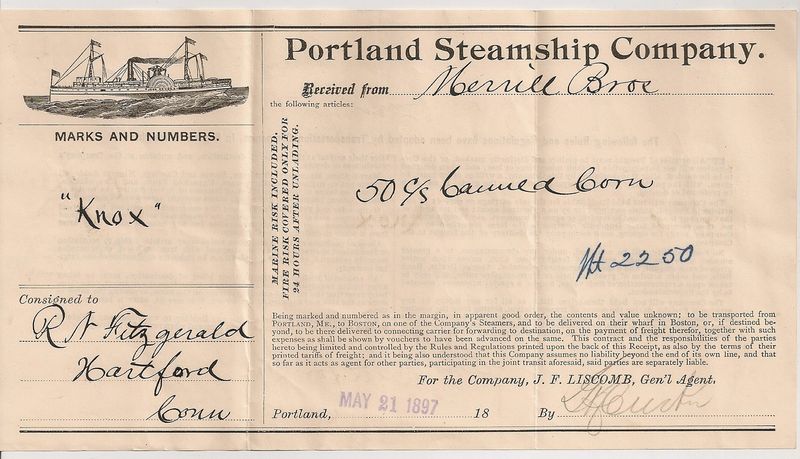
11365. (cargo receipt) Portland
Steamship Company. May 21, 1897. 8 ½” x 4 ¾”. This is a
8.5" by 4.75" May 21st, 1897, bill of way for 50 Cases of Canned Corn,
transported by the "Portland Steamship Company," for the "Merrill
Bros.," to R. N. Fitzgerald of Hartford, Connecticut. Note the great
graphic showing a walking beam side paddle wheel steamer. The Portland Steamship
Company started as the Portland Steam Packet Company in 1844, and was later
consolidated into the Eastern Steamship Company. One of their vessels, the
side-wheel steamship Portland, was one of the largest and most palatial
vessels afloat in New England during the 1890s. Built in 1889 by, the steamer
ran between Portland, Maine and Boston until its loss with all hands in 1898.
The Portland's loss was New England's greatest steamship disaster prior to the
year 1900. This receipt may be for goods that were carried on the Portland the
year prior to her loss. This document is in very good condition, with only 2
vertical creases, clean. (VG+). $34. (See also our original company framed photo
of the Portland.)
23368b.
[lot] Lorenzo Sitgreaves (ca. 1811-1888) –
U. S.
Lighthouse Engineer, Surveyor and topographical engineer.


During
the Mexican War Lorenzo Sitgreaves took part in the Battle of Buena Vista
and marched through Chihuahua, he led an 1851 Zuni and Colorado Rivers
survey expedition and for many years after was assigned to the Light House
Establishment and involved in the construction and repair of many of the
nation’s light stations. His career with the Light House Establishment
involved work on numerous light stations on the Atlantic and Great Lakes
coasts and his work can still be seen in hundreds of locations including
the 1858 Bodie Island Lighthouse, Cape Charles LH, La Pointe Lighthouse on
the southern shore of Lake Superior, and hundreds more. In addition, he
was in charge, Office of Lighthouse Engineer, at
Detroit
December 21, 1852, to December 11, 1856. During the Civil War, Sitgreaves
attained the rank of lieutenant colonel in the Corps of Engineers.
Sitgreaves conducted the first scientific expedition across
Arizona
in the early 1850’s and later the
Apache
Sitgreaves
National Forest
in
New Mexico
and
Arizona
was named for him. This rare lot from his personal files contains numerous
items and information chronicling his work during the 1850-60’s.
Included are:
1. Civil War era check register maintained by Major Lorenzo Sitgreaves,
6" x 8.25", marigold paper cover, handwritten on front, "Ist
National Bank,
Madison
,
Wis
, 1864, Aug. 3 to Oct. 22". 55pp. used -- appx. 162 checks. Some of
the names: Lieut. A Rood; Maj. G. R. Giddings; Maj. N. Richardson; Capt.
Wm. C. Young; Lieut. J. H. Purcell; Col. C. S. Lovell and more, and many
non-officers. Payment notations include: transport; rent; rations;
stationary; lodging; telegrams, "services clerk
Camp
Randall
." Unsigned by Sitgreaves, though he possibly wrote his name on one
of the checks. Also included is similar bankbook in account with
Maj. Sitgreaves.
2. U. S. Lighthouse Establishment, manuscript invoice/receipt, 1p.,
8" x 10", Sept. 1853, ADS signed three times, "L.
Sitgreaves" Capt. T.E. L.H. Insp. Top notes that Sitgreaves is owed
and appropriation of $61.50 "For fuel & quarters of the officers
of the Army serving on Lt. House duty - 3 March 1853" and "For
fuel and quarters while stationed at Detroit Mich on Lt. House duty, from
1 July to 30th Sept". Sitgreaves then certifies that the above was
for Lt. House use and then notes that he received payment on 30 Sept.
1853.
3. Original Survey Notes [in hand of Lorenzo Sitgreaves]. Two manuscripts:
1. 3 1/2pp., 8" x 10", Aug. 3, 1851, ink on blue paper. Reads,
"Method used in making observations for azimuth at [delta shape]
Mt. Pleasant
,
U. S.
Coast Survey" and "Result of observation for azimuth before and
after culmination." Appx. two pages of text, one page chart and one
and half pages of keys/formulas. The text notes, "The elongation mark
used in the observations was placed almost exactly in line to
Mt.
Blue
, on the summit of the next ridge of the mountains about a mile distant
from the station." Quite esoteric, however was written in the same
year that Sitgreaves led his noted survey expedition. Fine condition.
4. Mexican War Surveyor's Receipt - 1p., 7.75" x 9.75", Feb. 6,
1847,
Saltillo
,
Mexico
, signed "Dan Drake Henrie". [Note: The Battle of Buena Vista
took place a little south of
Saltillo
on Feb. 23, 1847 Sitgreaves was engaged in this battle and was breveted
captain for bravery.] Daniel "Dan" Drake Henrie (b. 1824), a
Mormon from
Nauvoo
,
IL
, joined the Mormon Battalion in 1846. He was a noted government surveyor
who participated in the surveying of the Mason Dixon line. In Sitgreaves
hand, the receipt notes that Henrie was due $50.60, "To Services as
assistant surveyor from the 1st to the 23rd Dec 1846, being 23 days at
$2.00 pr. day" and one ration per day at 20 cts per ration. Henrie
signs below noting that he received payment from Lieut. L. Sitgreaves T.
Engr. Although the bottom of the page notes, "Duplicate" the
signature of Henrie is not in Sitgreaves' hand. This is probably a second
copy for Sitgreaves' records. One 2" split, well away from text, and
a few edge nicks, otherwise excellent condition
5. Mixed assortment of items – fine gravure cabinet style portrait
photo, possibly Sitgreaves in his later years; retirement papers; letter
to Sitgreaves at age three from his aunt; billheads; original 1888 will
leaving his goods to Ms Mary Jesup Sitgreaves; 1878 hand written last
will; published will of brother Theodore R. Sitgreaves; 1882 letter
from brother; misc. letters/papers. Appx. 25 items.
An important lot relating to this noted lighthouse engineer. $585 net.
U.S.
LIGHTHOUSE ESTABLISHMENT. Original hand drawn architectural drawings for a:
Screw Pile Light House for 4th, 5th, and 6th Order Lenses [octagonal style] .
Engineer Secretary, U. S. Light House Board. 1880-1906.
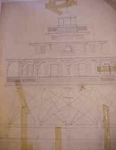
We have been very fortunate to come
across a large lot of original U. S. Light House Establishment architectural
drawings for the construction of various lighthouses, keeper’s dwellings, oil
houses, range beacons and more This lot originated from the Lighthouse
Establishment Engineering Offices and includes many one of a kind items.
This portion includes 11 drawings for a Screw Pile Light House for 4th,
5th, and 6th Order Lenses. Octagonal Screw Pile Type lighthouses represented in
this lot include: Mathias Point, VA., Hooper’s Straits & James Island, MD.
& Laurel Point, NC., Windmill Point, Shark Fin Shoal, Lower Cedar Point,
MD., Wade Point, NC., Pages Rock, VA., and Maryland Point, MD. Light Houses.
There were two basic styles of
screw-pile lighthouses – square and octagonal. Most lighthouses of each shape
were from the same basic plan, in fact many plan sheets have multiple lighthouse
names on them and they were reused over the years. Drawings are hand
drawn or printed, ink on paper and are done in from one to four colors each.
These original architectural drawings represent an unprecedented view into the
design and construction of this style of lighthouse. The drawings are quite
beautiful and would be wonderful for research or to frame for display. Condition
varies but as you might expect being early paper, the edges on many have
chipping and some small tears. Many have been tape reinforced both originally
and recently.
Eleven superb architectural views include:
Sheet # Full elevation and sectional view labeled Mathias
Point, VA. c.1883. hand drawn, 3-color ink on paper. 24" x 37".
Sheet # Plans First Floor Framing, Lantern Deck, Lantern
labeled Hooper’s Straits & James Island, MD. & Laurel Point, NC.
c.1883. hand drawn, 4-color ink on paper. 24" x 37".
Sheet # Details of Iron Work, Repair of Windmill Point
Lighthouse, labeled Windmill Point. c.1883. hand drawn, 2-color ink on paper.
24" x 37".
Sheet # Plans First and Second Story, labeled Shark Fin Shoal
LH. c.1883. hand drawn, 3-color ink on paper. 24" x 37".
Sheet # Soundings and Sectional Elevations, labeled Lower
Cedar Point, MD. c.1906. hand drawn, 4-color ink on paper. 24" x 37".
Sheet #5 Details of Iron Work. 16" x 24" printed on
paper. b/w. Wade Point, NC
Sheet #1 Half Plan Showing Framing First Floor I Beams.
16" x 24" printed on paper. b/w. Pages Rock, VA
Sheet #3 Details of Iron Work, ladders, etc. 16" x
24" printed on paper. b/w. Pages Rock, VA
Sheet #2 Details of Iron Work, etc. 16" x 24"
printed on paper. b/w. Pages Rock, VA
Sheet #4 Details of Iron Work, smoke pipe, etc. 16" x
24" printed on paper. b/w. Pages Rock, VA
Sheet #5 Lantern Apparatus of the 4th, 5th & 6th Orders.
16" x 24" printed on paper. b/w. Pages Rock, VA [Maryland Point, MD.
#23240 Set 11 drawings $3,295 net. Priced individually on
request. Photos available.
10345.
[Light-House Service District Maps].
U. S.
Light-House Service. c. June 30, 1891. A rare opportunity to obtain an official
U. S. Light-House Service District charts of all district aids to navigation as
bound in their Annual Reports. Normally these charts are included within the
Annual Reports and we are unable to offer them separately but we have found a
lot of disbound charts in good condition. These are fine for matting and framing
for your wall. Charts detail the entire Light-House District in three colors,
and show all lighthouses, beacons, light vessels, fog signals, lighted buoys,
Light-House Depots, and more. Charts average 8 ½” x 10” in size and are
overall clean, may have very light stain, with only one light original
fold, light age toning. A rare chance to obtain the chart of your District for
framing. (VG).
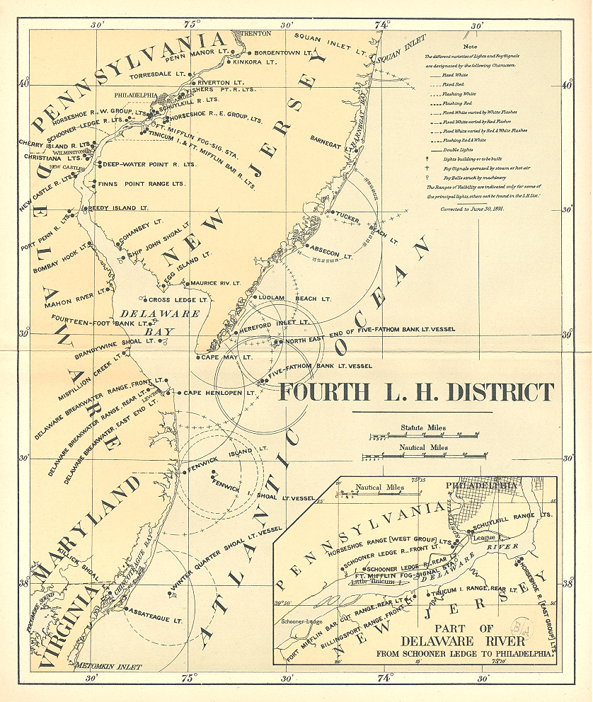
FIRST
LIGHT-HOUSE DISTRICT. From the head of navigation on the St.
Croix River
,
Maine
to
Hampton Harbor
,
New Hampshire
. Includes all of
Maine
and
New Hampshire
.
$44.
SECOND
LIGHT-HOUSE DISTRICT. From
Hampton Harbor
,
New Hampshire
to Elisha Ledge off
Warren
,
Rhode Island
. Includes all of Cape Cod, Nantucket and
Martha’s Vineyard
.
$44.
THIRD
LIGHT-HOUSE DISTRICT. From Elisha Ledge off
Warren
, Rhode Island to and including a point on the coast of
New Jersey
opposite Shrewsbury Rocks.
$44.
PART
OF THE THIRD LIGHT-HOUSE DISTRICT. Includes all of
Lake Champlain
.
$18.
FOURTH
LIGHT-HOUSE DISTRICT. From a point on the coast of New Jersey
opposite Shrewsbury Rocks to and including Metomkin Inlet, Virginia. Includes
New Jersey
,
Delaware
,
Maryland
and
Virginia
.
$44.
FIFTH
LIGHT-HOUSE DISTRICT. From
Metomkin Inlet
,
Virginia
to and including
New River Inlet
,
North Carolina
. $44.
SIXTH
LIGHT-HOUSE DISTRICT. From
New River Inlet
,
North Carolina
to and including Jupiter Inlet Light-Station,
Florida
. Includes part of
North Carolina
, all of
South Carolina
,
Georgia
, and
Florida
between the limits named. $44.
SEVENTH
LIGHT-HOUSE DISTRICT. From a point south of Jupiter Inlet
Light-Station to
Perdido Entrance
,
Florida
. Includes all of the sea and Gulf Coasts of
Florida
.
$44.
EIGHTH
LIGHT-HOUSE DISTRICT. From
Perdido Entrance
,
Florida
to the Rio Grande, the southern boundary of
Texas
. Includes all of the
Gulf
Coast
and lower
Mississippi River
.
$44.
NINTH
LIGHT-HOUSE DISTRICT. Includes all of Lake Michigan,
Green Bay
and tributary waters.
$44.
TENTH
LIGHT-HOUSE DISTRICT. Extends from the mouth of the
St.
Regis
River
,
St. Lawrence River
,
New York
to and including Grassy Island, Detroit River, Michigan. Includes the waters of
Lakes
Erie
and
Ontario
, and the upper part of the St. Lawrence, the Niagara, and the lower part of the
Detroit
rivers.
$44.
ELEVENTH
LIGHT-HOUSE DISTRICT. Extends from the Grassy Island Light Station,
Detroit River
,
Michigan
to the head of Lake Superior including the waters of Lakes St. Clair, Huron,
and
Superior
and the upper part of the
Detroit
River
, the St. Clair and St. Mary’s Rivers, and part of the Straits of Mackinac.
$44.
TWELFTH
LIGHT-HOUSE DISTRICT. From the boundary between
California
and
Mexico
to the boundary between
California
and
Oregon
.
$44.
THIRTEENTH
LIGHT-HOUSE DISTRICT. From the boundary between
California
and
Oregon
to the northern boundary of the
United States
and includes
Alaska
. Includes all of
Oregon
and
Washington
, and Alaskan waters.
$44.
U. S. Light-House
Service District Charts
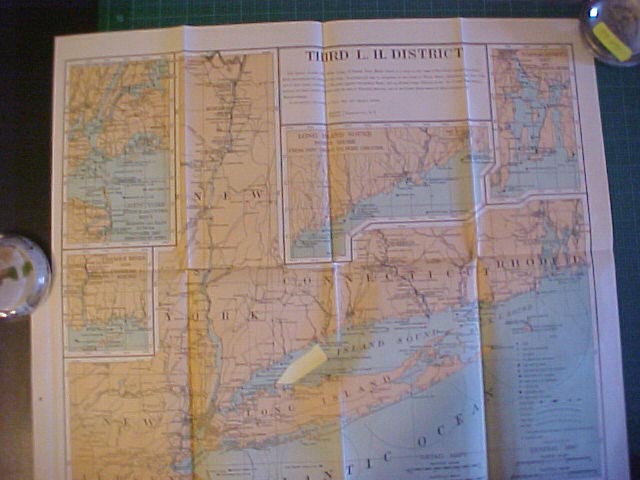
20178. [Light-House District Maps]. U. S. Light-House
Service. c. 1900-1908. A rare opportunity to obtain an official U. S.
Light-House Service District charts of all district aids to navigation as
bound in their Annual Reports. Normally these charts are included within
the Annual Reports and we are unable to offer them separately but we have
found a lot of disbound charts in wonderful condition. These are perfect
for matting and framing for your wall. Charts detail the entire
Light-House District in three colors, and show all lighthouses, beacons,
light vessels, fog signals, lighted buoys, Light-House Depots, and more.
Charts average about 16" x 20" in size and are clean and crisp,
with only light original folds. A rare chance to obtain the chart of your
District, ideal for framing. (VG+).
UNITED STATES. Outline Map shows all of the United States Light-House
Districts with the more important lights noted. Includes all of
continental United States and Alaska. $88.
FIRST LIGHT-HOUSE DISTRICT. From the head of navigation on the St.
Croix River, Maine to Hampton Harbor, New Hampshire. Includes all of Maine
and New Hampshire. $88.
SECOND LIGHT-HOUSE DISTRICT. From Hampton Harbor, New Hampshire to
Elisha Ledge off Warren, Rhode Island. Includes all of Cape Cod, Nantucket
and Martha’s Vineyard. $88.
THIRD LIGHT-HOUSE DISTRICT. From Elisha Ledge off Warren, Rhode Island
to and including a point on the coast of New Jersey opposite Shrewsbury
Rocks. $88.
PART OF THE THIRD LIGHT-HOUSE DISTRICT. Includes all of Lake Champlain.
$44.
FOURTH LIGHT-HOUSE DISTRICT. From a point on the coast of New Jersey
opposite Shrewsbury Rocks to and including Metomkin Inlet, Virginia.
Includes New Jersey, Delaware, Maryland and Virginia. $88.
FIFTH LIGHT-HOUSE DISTRICT. From Metomkin Inlet, Virginia to and
including New River Inlet, North Carolina. $88.
SIXTH LIGHT-HOUSE DISTRICT. From New River Inlet, North Carolina to and
including Jupiter Inlet Light-Station, Florida. Includes part of North
Carolina, all of South Carolina, Georgia, and Florida between the limits
named. $88.
SEVENTH LIGHT-HOUSE DISTRICT. From a point south of Jupiter Inlet
Light-Station to Perdido Entrance, Florida. Includes all of the sea and
Gulf Coasts of Florida. $88.
EIGHTH LIGHT-HOUSE DISTRICT. From Perdido Entrance, Florida to the
southern boundary of Texas. Includes all of the Gulf Coast and lower
Mississippi River. $88.
NINTH LIGHT-HOUSE DISTRICT. Includes all of Lake Michigan, Green Bay
and tributary waters. $88.
TENTH LIGHT-HOUSE DISTRICT. Extends from the mouth of the St. Regis
River, St. Lawrence River, New York to the mouth of the River Rouge,
Detroit River, Michigan. Includes the waters of Lakes Erie and Ontario,
and the upper part of the St. Lawrence, the Niagara, and the lower part of
the Detroit rivers. $78.
ELEVENTH LIGHT-HOUSE DISTRICT. Extends from the mouth of the River
Rouge, Detroit River, Michigan to the westerly end of Lake Superior
including the waters of Lake St, Clair, Huron, and Superior and the upper
part of the Detroit River, the St. Clair and St. Mary’s Rivers, and part
of the Straits of Mackinac. $78.
TWELFTH LIGHT-HOUSE DISTRICT. From the boundary between California and
Mexico to the boundary between California and Oregon. $88.
THIRTEENTH LIGHT-HOUSE DISTRICT. From the boundary between California
and Oregon to the northern boundary of the United States and includes
Alaska. Includes all of Oregon and Washington, and Alaskan waters. $88.
FOURTEENTH LIGHT-HOUSE DISTRICT. Extends on the Ohio River from
Pittsburgh, Pa., to Cairo, Ill., on the Tennessee River 255 miles, and on
the Great Kanawha 73 miles. $54.
FIFTEENTH LIGHT-HOUSE DISTRICT. Extends on the Mississippi River from
the head of navigation to Cairo, Ill., and on the Missouri River to Kansas
City, Mo., and on the Illinois River from LaSalle to its mouth. $54.
SIXTEENTH LIGHT-HOUSE DISTRICT. Extends on the Mississippi River from
the head of navigation to Cairo, Ill., to New Orleans, La., and on the Red
River. $54.
LIGHT-HOUSE CHART. Includes West Indies between the Mona and Virgin
Passages comprising Puerto Rico and dependencies, and all of the Hawaiian
Islands. $38.
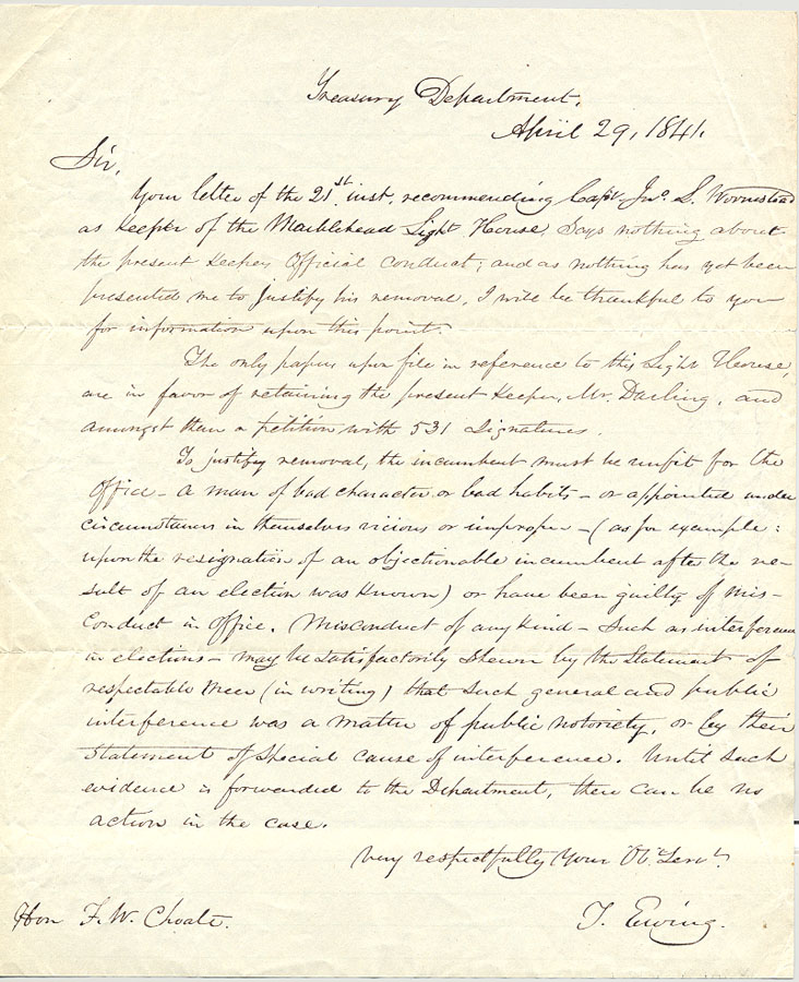
Marblehead
Light-House
, Mass. April 29, 1841.
Rare
letter regarding replacement of the Light Keeper.:
[document
– office copy – written in hand.
8” x 9 ¾”. 1 page.].
“[to]
Hon. F. W. Choate, April
29, 1841
Sir:
Your letter of the 21st
inst. Recommending Capt Jw S Worcester as Keeper of the Marblehead Light
House says nothing about the present keeper’s official conduct; and as
nothing has yet been presented me to justify his removal, I will be
thankful to you for information upon this point. The
only papers upon file in reference to this Light House are in favor of
retaining the present Keeper, Mr Darling, and amongst them a petition
with 531 signatures. To justify removal, the incumbent must be unfit for
the office – a man of bad character or bad habits – or appointed
under circumstances in themselves vicious or improper – (as for
example: upon the resignation of an objectionable incumbent after the
result of an election was known) or have been guilty of misconduct in
office. Misconduct of any kind – such as interference in elections –
may be satisfactorily shown by the statement of respectable men (in
writing) that such a general and public interference was a matter of
public notoriety, or by their statement of special cause of
interference. Until such evidence is forwarded to the Department, there
can be no action in the case. Very
respectfully, Your Obt Servent, [signed] T [Thomas] Ewing. [Secy of the
Treasury].”
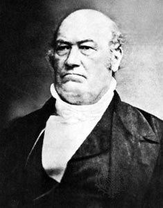
Signature:
Thomas Ewing, Sr. (December 28, 1789– October 26, 1871) was a National
Republican and Whig politician from Ohio. He served in the U.S. Senate
as well as serving as the Secretary of the Treasury (1841 under
Presidents William Henry Harrison and John Tyler) and the first
Secretary of the Interior.
Keeper
Ezekiel Darling (1835-1860): Apparently Mr. Choate was unsuccessful in
having Keeper Darling removed, for he would serve in that capacity until
1860. The first lighthouse at Marblehead, a 23-foot white tower and a
keeper's cottage attached to the tower by a covered walkway, were built
near a small fort on Marblehead Neck in 1835. The first keeper-at $400
yearly‚was Ezekiel Darling, a native of Duxbury, Massachusetts, and
former chief gunner on the U.S.S. Constitution. He had first gone to sea
at the age of eight or nine, and he was wounded in the War of 1812. It
was reported that Darling did not receive a pension because he was
considered "disfigured”, but not disabled. Darling was in charge
when the engineer I. W. P. Lewis examined the station. The keeper
provided a statement for Lewis's report to Congress in 1843: "The
tower is leaky about the window casing, there being no recess in the
brick for the window frames. The lantern sweats considerably, and
formerly I wiped up large quantities of water accumulating from this
cause. I now admit as much air as the state of the weather will permit,
which in some degree remedies this evil. The dwelling-house is very
damp, and the water comes through the walls. The chimneys are all
smoky." Lewis praised Darling in his report. "Perfect order,
cleanliness, and apparent comfort," he wrote, "reign
throughout the whole establishment, much to the credit of the
keeper." By 1860, Keeper Darling was about 70 and almost blind, and
soon retired after 25 years as keeper. Jane C. Martin, a Marblehead
native, replaced Keeper Darling. She was said to be the only woman
lighthouse keeper on the East Coast at the time she was appointed.
#715.
$225.
28420.
(documents) U.S. Lighthouse Service, 11th District.
Radiophone Tests and Equipment. February 20, 1929. 4 pieces. Lot
includes typed letter on Lighthouse Service stationery acknowledging assistance
in evaluating signal strength and quality during recent radiophone tests
conducted by Lighthouse Service radio station WWR. Document is signed by the
Superintendent of Lighthouses, 11th District. Included is a second sheet
describing the 50 watt crystal controlled transmitter, along with another
printed photo of the equipment, which was constructed by Lighthouse Service
personnel at the 11th District shops. Included also is the original mailing
envelope with printed Lighthouse Service return address. Nice Lighthouse Service
lot, good information. Clean, some wear. (VG). $65.
28398e.
[proposal] Engineer Office, U.S. Army [
U. S.
Light-House Service]. ADVERTISEMENT, SPECIFICATIONS
AND PROPOSAL FOR MATERIAL FOR RANGE TOWERS AT FORT MONROE, VA.
January 21, 1902. 10p. (5 sheets). 8 ½” x 12”. Without wraps, unbound.
Contains complete Advertisement, Guarantee, Proposal form, Specifications for
furnishing all structural steel and iron necessary for construction of six range
light towers, 5 of the low type and 1 tower of the high type. Good for research,
interesting reading. Only light soiling, intact save a bit brittle, some
edge chipping. (VG-). $54.
28398f.
[proposal] U.S. Engineer Office. ADVERTISEMENT,
SPECIFICATIONS AND PROPOSAL FOR CONSTRUCTION MATERIAL FOR FORT WOOL, VA. January
27, 1902. 12p. (6 sheets). 8 ½” x 12”. Without wraps, unbound. Contains
complete Advertisement, Guarantee, Proposal form, Specifications for furnishing
various construction items to Fort Wool including Portland Cement, stone, sand,
yellow pine lumber and ties, various steel and iron items, and more. Good for
research, interesting reading. Only light soiling, intact save a bit
brittle, some edge chipping. (VG-). $24.

27299.
(a paper read before the Philosophical Society of Washington) Johnson, Arnold
Burges, Clerk, U. S. Light House Board. THE HISTORY
OF THE LIGHT HOUSE ESTABLISHMENT OF THE UNITED STATES. April 2, 1881. 7p.
Inscribed by the author. Without wraps. Account of a paper prepared by Mr.
Johnson to be read elsewhere, traces the rise and progress from the first beacon
on Point Allerton raised in 1673 to the present (1881). Includes information on
sound propagation and the work of Professor Joseph Henry, expensed and annual
budgets for lighting and a number of other points. Inscribed by Mr. Johnson
to “Hon. Lorenzo Johnson with the compliments of his bro[ther] Arnold”, with
some additional notes in his hand. Light soiling, early folds. Rare piece by
the Clerk of the U. S. Light House Board. (VG). $112.
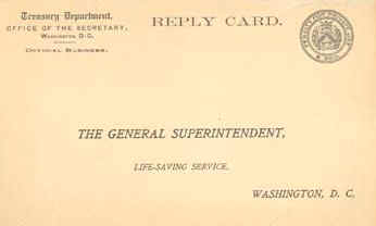
26320.
(reply card) U. S. Life Saving Service c.1912.
Early reply card addressed to the General Superintendent was used to continue or
decline further receipt of future Annual Reports of the Life Saving Service.
This particular card is filled out by the Providence, RI Historical Society
declining future reports. Postmarked 1912. Great collectible, address side is
clean and unmarked, perfect for framing. (VG+). $48.
10345.
[Light-House Service District Maps].
U. S.
Light-House Service. c. June 30, 1891. A rare opportunity to obtain an
official U. S. Light-House Service District charts of all district aids
to navigation as bound in their Annual Reports. Normally these charts
are included within the Annual Reports and we are unable to offer them
separately but we have found a lot of disbound charts in good condition.
These are fine for matting and framing for your wall. Charts detail the
entire Light-House District in three colors, and show all lighthouses,
beacons, light vessels, fog signals, lighted buoys, Light-House Depots,
and more. Charts average 8 ½” x 10” in size and are overall clean,
may have very light stain, with only one light original fold,
light age toning. A rare chance to obtain the chart of your District for
framing. (VG).

FIRST
LIGHT-HOUSE DISTRICT. From the head of navigation on the St.
Croix River
,
Maine
to
Hampton Harbor
,
New Hampshire
. Includes all of
Maine
and
New Hampshire
.
$44.
SECOND
LIGHT-HOUSE DISTRICT. From
Hampton Harbor
,
New Hampshire
to Elisha Ledge off
Warren
,
Rhode Island
. Includes all of Cape Cod, Nantucket and
Martha’s Vineyard
.
$44.
THIRD
LIGHT-HOUSE DISTRICT. From Elisha Ledge off
Warren
, Rhode Island to and including a point on the coast of
New Jersey
opposite Shrewsbury Rocks.
$44.
PART
OF THE THIRD LIGHT-HOUSE DISTRICT. Includes all of
Lake Champlain
.
$18.
FOURTH
LIGHT-HOUSE DISTRICT. From a point on the coast of New Jersey
opposite Shrewsbury Rocks to and including Metomkin Inlet, Virginia.
Includes
New Jersey
,
Delaware
,
Maryland
and
Virginia
.
$44.
FIFTH
LIGHT-HOUSE DISTRICT. From
Metomkin Inlet
,
Virginia
to and including
New River Inlet
,
North Carolina
. $44.
SIXTH
LIGHT-HOUSE DISTRICT. From
New River Inlet
,
North Carolina
to and including Jupiter Inlet Light-Station,
Florida
. Includes part of
North Carolina
, all of
South Carolina
,
Georgia
, and
Florida
between the limits named. $44.
SEVENTH
LIGHT-HOUSE DISTRICT. From a point south of Jupiter Inlet
Light-Station to
Perdido Entrance
,
Florida
. Includes all of the sea and Gulf Coasts of
Florida
.
$44.
EIGHTH
LIGHT-HOUSE DISTRICT. From
Perdido Entrance
,
Florida
to the Rio Grande, the southern boundary of
Texas
. Includes all of the
Gulf
Coast
and lower
Mississippi River
.
$44.
NINTH
LIGHT-HOUSE DISTRICT. Includes all of Lake Michigan,
Green Bay
and tributary waters.
$44.
TENTH
LIGHT-HOUSE DISTRICT. Extends from the mouth of the
St.
Regis
River
,
St. Lawrence River
,
New York
to and including Grassy Island, Detroit River, Michigan. Includes the
waters of
Lakes
Erie
and
Ontario
, and the upper part of the St. Lawrence, the Niagara, and the lower
part of the
Detroit
rivers.
$44.
ELEVENTH
LIGHT-HOUSE DISTRICT. Extends from the Grassy Island Light
Station,
Detroit River
,
Michigan
to the head of Lake Superior including the waters of Lakes St. Clair,
Huron, and
Superior
and the upper part of the
Detroit
River
, the St. Clair and St. Mary’s Rivers, and part of the Straits of
Mackinac.
$44.
TWELFTH
LIGHT-HOUSE DISTRICT. From the boundary between
California
and
Mexico
to the boundary between
California
and
Oregon
.
$44.
THIRTEENTH
LIGHT-HOUSE DISTRICT. From the boundary between
California
and
Oregon
to the northern boundary of the
United States
and includes
Alaska
. Includes all of
Oregon
and
Washington
, and Alaskan waters.
$44.
U.S.
LIGHTHOUSE ESTABLISHMENT. Original hand drawn architectural drawings for a:
Screw Pile Light House for 4th, 5th, and 6th Order Lenses [octagonal style] .
Engineer Secretary, U. S. Light House Board. 1880-1906.

We have been very fortunate to come
across a large lot of original U. S. Light House Establishment architectural
drawings for the construction of various lighthouses, keeper’s dwellings, oil
houses, range beacons and more This lot originated from the Lighthouse
Establishment Engineering Offices and includes many one of a kind items.
This portion includes 11 drawings for a Screw Pile Light House for 4th,
5th, and 6th Order Lenses. Octagonal Screw Pile Type lighthouses represented in
this lot include: Mathias Point, VA., Hooper’s Straits & James Island, MD.
& Laurel Point, NC., Windmill Point, Shark Fin Shoal, Lower Cedar Point,
MD., Wade Point, NC., Pages Rock, VA., and Maryland Point, MD. Light Houses.
There were two basic styles of
screw-pile lighthouses – square and octagonal. Most lighthouses of each shape
were from the same basic plan, in fact many plan sheets have multiple lighthouse
names on them and they were reused over the years. Drawings are hand
drawn or printed, ink on paper and are done in from one to four colors each.
These original architectural drawings represent an unprecedented view into the
design and construction of this style of lighthouse. The drawings are quite
beautiful and would be wonderful for research or to frame for display. Condition
varies but as you might expect being early paper, the edges on many have
chipping and some small tears. Many have been tape reinforced both originally
and recently.
Eleven superb architectural views include:
Sheet # Full elevation and sectional view labeled Mathias
Point, VA. c.1883. hand drawn, 3-color ink on paper. 24" x 37".
Sheet # Plans First Floor Framing, Lantern Deck, Lantern
labeled Hooper’s Straits & James Island, MD. & Laurel Point, NC.
c.1883. hand drawn, 4-color ink on paper. 24" x 37".
Sheet # Details of Iron Work, Repair of Windmill Point
Lighthouse, labeled Windmill Point. c.1883. hand drawn, 2-color ink on paper.
24" x 37".
Sheet # Plans First and Second Story, labeled Shark Fin Shoal
LH. c.1883. hand drawn, 3-color ink on paper. 24" x 37".
Sheet # Soundings and Sectional Elevations, labeled Lower
Cedar Point, MD. c.1906. hand drawn, 4-color ink on paper. 24" x 37".
Sheet #5 Details of Iron Work. 16" x 24" printed on
paper. b/w. Wade Point, NC
Sheet #1 Half Plan Showing Framing First Floor I Beams.
16" x 24" printed on paper. b/w. Pages Rock, VA
Sheet #3 Details of Iron Work, ladders, etc. 16" x
24" printed on paper. b/w. Pages Rock, VA
Sheet #2 Details of Iron Work, etc. 16" x 24"
printed on paper. b/w. Pages Rock, VA
Sheet #4 Details of Iron Work, smoke pipe, etc. 16" x
24" printed on paper. b/w. Pages Rock, VA
Sheet #5 Lantern Apparatus of the 4th, 5th & 6th Orders.
16" x 24" printed on paper. b/w. Pages Rock, VA [Maryland Point, MD.
#23240 Set 11 drawings $3,295 net. Priced individually on
request. Photos available.
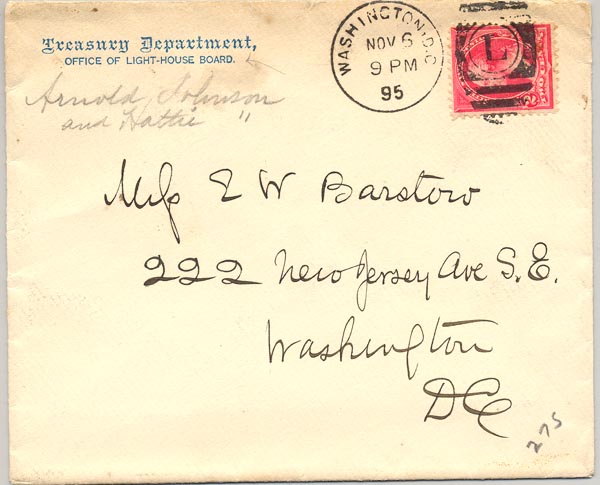
1063. (envelope from) Arnold
Burges Johnson, Chief Clerk, U.S. Light House Board, Washington, DC.
c.1895. Intact envelope addressed to a Washington address
bears a return address of “Arnold Johnson and Hattie [in pencil],
Treasury Department, Office of Light House Board”. Envelope is
postmarked November 6, 1895. Arnold Burges Johnson, was born in
Rochester, Mass., June 17, 1834. He was married May 12, 1857, at
Brooklyn, N. Y., to Harriet [“Haittie”] M, Barrows. Mr. Johnson was
educated at the Rochester Academy in Putnam, Ohio, at Madison College in
Pennsylvania, and the Columbian College Law School, from which last he
was graduated in 1886. He served as Chief Clerk of the Light-House Board
from 1869 to this date, except for a year, '73-74, when he was editing
the Republican at Hackensack, N. J., and practicing law. He returned to
the Light- House Board in March, '74, at the request of the Department,
being allowed to finish up afterwards the cases he had pending in the U.
S. Supreme Court. He was a member of several scientific societies and
and has written somewhat on scientific subjects, much of which has been
published in England, France, and Spain. He is the author of The Modem
Light-House Service, a wonderful account of the work of the Lighthouse
Service, and many Magazine articles. An interesting piece from this
important Light House Board official. (VG). $34.
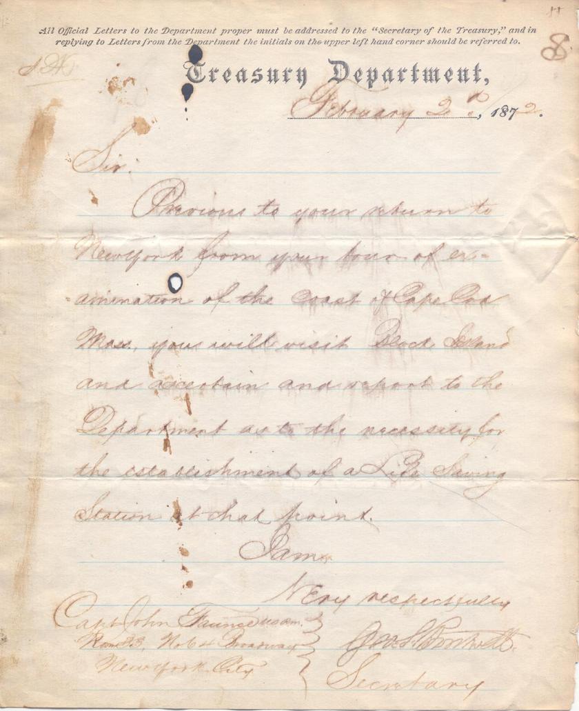
2705. (document) U.
S. Life Saving Service. Establishment of a Life Saving Station on Block Island.
February 2, 1872. Original one page official manuscript document on
Treasury Department stationary, dated February 2, 1872, whereby George S.
Boutwell , Secretary of the Treasury, and Sumner Increase Kimball , the chief of
the Treasury Department’s Revenue Marine Division, orders Captain John Faunce
, United States Revenue Marine , to proceed to Block Island for the purpose of
reporting upon the necessity for the establishment of a Life Saving Station at
that point. Initialed in the upper left hand corner by Kimball, and signed in
hand by Boutwell. Document reads: “S.I.K. Treasury Department February 2d,
1872. Sir: Previous to your return to New York from your tour of examination of
the coast of Cape Cod, Mass., you will visit Block Island and ascertain and
report to the Department as to the necessity for the establishment of a Life
Saving Station at that point. I am, Very respectfully Geo. S. Boutwell,
Secretary. [to] Capt John Faunce U.S.R.M. Room 33, No 64 Broadway, New
York City.” One page document; 7 7/8 x 9 3/4; previously folded in horizontal
thirds; remnants of indistinguishable light pencil notations at upper left and
upper right; One, 1/4" burn hole on line three; chipping to upper &
lower right margins. One, 3/8" to 3/4" wide strip of discolored
backing material on verso that extends the entire height at right margin from
being bound in original letter book. Light foxing and expected age toning.
Script is slightly blurred. (VG-). $325 net
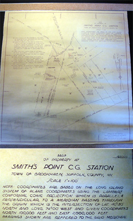
29224. Map
of Property at Smith’s Point Coast Guard Station Town of Brookhaven,
Suffolk County, N.Y. c. 1950. Scale 1” = 100’. 18” x 19
½”. Map is well drafted on blue-print paper, blue on heavy
yellow-tinted paper. Contains typical plot plan information including
dimensions and directional information, location of Coast Guard station
and boathouse, watch tower, as well as property boundary markers,
abutters, telephone lines, flowing well, property owner names penciled
in; mean high water line, base of the dunes and giving a specific
ownership tally to the left of the map proper, eg. ".B. Land
Occupied by the Smith's Point C.G. Station and Quit Claimed by Eugenie
A. T. Smith, Heir of Egbert T. Smith to Curtis J. Davis and Wife Lillian
M. & recorded on Nov. 17, 1949 & July 31, 1950." etc..
Overall clear, some closed edge-tears; occasional light soiling;
otherwise in very good condition and interesting Long Island historical
ephemera concerning the area. Good for reference of framing. (VG). $74.
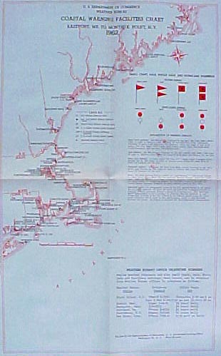
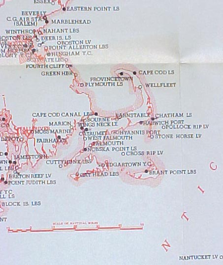
26159.
(chart) U. S. Department of Commerce, Weather Bureau. COASTAL
WARNING FACILITIES CHART. 1962. Great for framing, these charts
show in good detail all of the U. S. Coast Guard light stations
(lighthouses), lifeboat stations and light vessels that displayed
day and / or night weather warning signals. Also includes in color a diagram
if the weather signals, as well as a complete listing of weather broadcast
stations. Two color red-black maps have beautiful contrast and are perfect
for framing. Pick the map of your area to locate those old Coast Guard
lifeboat stations that no longer exist. Clean, crisp, with original folds
but will mount nicely. All measure 12” x 19” unless otherwise noted.
e.
Morgan City, LA to Apalachicola, FL. $24
f.
Puerto Rico and Virgin Islands. 12” x 12” $16
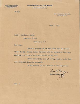
2942. (document)
U. S.
Department of Commerce, Lighthouse Service, Office of
Inspector, 6th District, Charleston, S.C. June 5, 1914. One page typed
letter, signed by the Superintendent, notes the mailing of property deed
and requests that receipt be acknowledged. One page on original
Lighthouse Service letterhead, signed in hand. Clean, crisp, light age
toning. (VG+). $38.
6744
[Topographic Maps].
U.S.
Geological Survey. 1940 – 1953 edition. Massachusetts Coastline. Sizes
from 16 ½” x 21” to 22” x 27”. The scale of the maps are
1:31,680 to 1:24,000, with contour lines at 10-foot intervals.
Beautiful, early, three color topographic maps show the important
contours and features of the area including the Lighthouses and
Life-Saving Stations, Lightships and more, as well as roads and
important town buildings, etc. Also includes all roads, railway lines,
shoals and bars, and much more. Maps are quite desirable for framing and
are overall clean. Include stamp on field of “Library Dept of
Geology”. Would be wonderful framed to show the area in great detail.
These early coastal maps are most desirable for display and bring a
premium, particularly on the
Cape
and the islands. (VG).
qq-6.
Sagamore Quadrangle. Includes most
of Plymouth, Cape Cod Canal, part of Bourne, Sandwich, Cape Cod Bay.
1951. 22” x 27”. $24.
qq-9.
Hyannis Quadrangle. Includes most of
Barnstable of Centerville, Yarmouth, part of Sandy Neck, Barnstable
Harbor, Hyannis Barbor, Nantucket Sound, Cape Cod Bay. 1950. 22” x
27”. $24.
qq-12.
Plymouth Quadrangle. Includes most
of Plymouth, part of Kingston, Plymouth Bay, Saquish Head. 1950. 22” x
27”. $24.
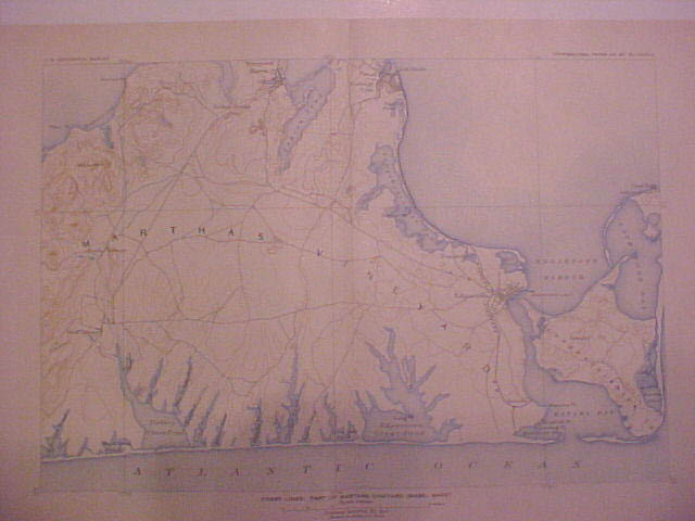
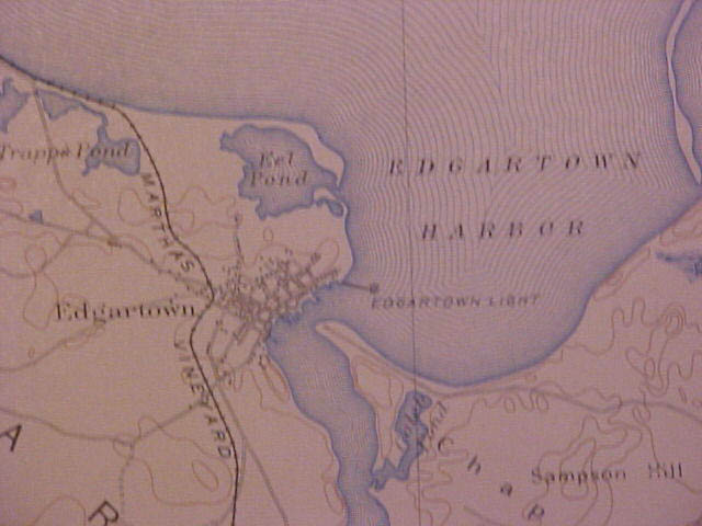
6744r,v. [Topographic
Plate]. COAST LINES: PART OF MARTHA'S
VINEYARD
MASS.
US Geological Survey. c.1908. Size 10”h x 16”. Double page
plate from early report. Beautiful, early, three color topographic map
shows the important contours and features of the area including the
Lighthouses and Life-Saving Stations, as well as roads, harbor and
important features. This map includes most of the island, from Chilmark
Pond and Lamberts Cove east to Oak Bluffs to the northeast and
Cape
Pogue
to the east. Lighthouses include Cape Pogue Light and
Edgartown Light. Also includes harbors, shoals and bars, and much more.
Plate is quite desirable for framing. Unusually clean and crisp, a
beautiful piece. These early coastal maps are most desirable for display
and bring a premium, particularly on the
Cape
and the islands. (F). $118 net.
6744s,ii. [Topographic Plate].
COAST LINES: PARTS OF
PROVINCETOWN
AND
WELLFLEET
MASS.
US Geological Survey. c.1908. Size 10”h x 16”. Double page
plate from early report. Beautiful, early, three color topographic map
shows the important contours and features of the area including the
Lighthouses and Life-Saving Stations, as well as roads, harbor and
important features. This map includes all of the outer
Cape
from
Provincetown
to
Bound
Brook
Island
and Gull Pond in Wellfleet. U. S. Life-Saving Stations include Race Point,
Peaked Hill Bar, High Head,
Highland
and
Pamet
River
. Lighthouses include Long Point, Wood End, Race Point, and Highland
Light. Also includes harbors, shoals and bars, and much more. Plate is
quite desirable for framing. Unusually clean and crisp, a beautiful piece.
These early coastal maps are most desirable for display and bring a
premium, particularly on the
Cape
and the islands. (F). $88 net.
Additional
areas and locations available in same 1908 series including:
Boothbay, Maine, Deer Isle, Maine, Morro Bay, Ca., Great South Bay, NY.,
Atlantic City, NJ., Sandy Hook, NJ., Presque Isle Bay, PA., San Francisco
Bay, Ca., Bolinas Bay, Ca., Sodus Bay, NY., Cape Blanco, Or., Oceanside,
Ca., Chesapeake Bay, Md., Buzzards Bay, Ma., Niagara Falls, NY., East
Delta, La., Williamston, NC., St. Louis, Mo., Yosemite Valley, Ca.,
Yellowstone Canyon, and more. Pricing $44 - $78 each.
See below for additional coastal
topographic maps.
U.S.
LIGHTHOUSE ESTABLISHMENT. Original hand drawn architectural drawings for
a: Screw Pile Light House for 4th, 5th, and 6th Order Lenses [octagonal
style] . Engineer
Secretary, U. S. Light House Board. 1880-1906.

We have been very fortunate
to come across a large lot of original U. S. Light House Establishment
architectural drawings for the construction of various lighthouses,
keeper’s dwellings, oil houses, range beacons and more This lot
originated from the Lighthouse Establishment Engineering Offices and
includes many one of a kind items. This portion
includes 11 drawings for a Screw Pile Light House for 4th, 5th, and 6th
Order Lenses. Octagonal Screw Pile Type lighthouses represented in this
lot include: Mathias Point, VA., Hooper’s Straits & James Island,
MD. & Laurel Point, NC., Windmill Point, Shark Fin Shoal, Lower
Cedar Point, MD., Wade Point, NC., Pages Rock, VA., and Maryland Point,
MD. Light Houses.
There were two basic styles
of screw-pile lighthouses – square and octagonal. Most lighthouses of
each shape were from the same basic plan, in fact many plan sheets have
multiple lighthouse names on them and they were reused over the years. Drawings
are hand drawn or printed, ink on paper and are done in from one to four
colors each. These original architectural drawings represent an
unprecedented view into the design and construction of this style of
lighthouse. The drawings are quite beautiful and would be wonderful for
research or to frame for display. Condition varies but as you might
expect being early paper, the edges on many have chipping and some small
tears. Many have been tape reinforced both originally and recently.
Eleven superb architectural views include:
Sheet # Full elevation and sectional view labeled
Mathias Point, VA. c.1883. hand drawn, 3-color ink on paper. 24" x
37".
Sheet # Plans First Floor Framing, Lantern Deck,
Lantern labeled Hooper’s Straits & James Island, MD. & Laurel
Point, NC. c.1883. hand drawn, 4-color ink on paper. 24" x
37".
Sheet # Details of Iron Work, Repair of Windmill Point
Lighthouse, labeled Windmill Point. c.1883. hand drawn, 2-color ink on
paper. 24" x 37".
Sheet # Plans First and Second Story, labeled Shark
Fin Shoal LH. c.1883. hand drawn, 3-color ink on paper. 24" x
37".
Sheet # Soundings and Sectional Elevations, labeled
Lower Cedar Point, MD. c.1906. hand drawn, 4-color ink on paper.
24" x 37".
Sheet #5 Details of Iron Work. 16" x 24"
printed on paper. b/w. Wade Point, NC
Sheet #1 Half Plan Showing Framing First Floor I
Beams. 16" x 24" printed on paper. b/w. Pages Rock, VA
Sheet #3 Details of Iron Work, ladders, etc. 16"
x 24" printed on paper. b/w. Pages Rock, VA
Sheet #2 Details of Iron Work, etc. 16" x
24" printed on paper. b/w. Pages Rock, VA
Sheet #4 Details of Iron Work, smoke pipe, etc.
16" x 24" printed on paper. b/w. Pages Rock, VA
Sheet #5 Lantern Apparatus of the 4th, 5th & 6th
Orders. 16" x 24" printed on paper. b/w. Pages Rock, VA
[Maryland Point, MD.
#23240 Set 11 drawings $3,295 net. Priced individually
on request. Photos available.
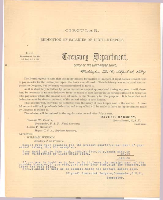
25322b. (Circular No. 83) REDUCTION
OF SALARIES OF LIGHT-KEEPERS. Light-House Board. Circular No.
83 of 1889. August 5, 1889. One page 8” x 10” printed Circular as
issued, refers to Circular No. 38 necessitating the reduction in salaries,
indicating that Congress was ill-advised as to the nature and amount of
the deficit by the Light-House Board, and that Congress did make an
appropriation to meet the anticipated deficit based on the facts presented
to it, but said appropriation was insufficient, hence the necessity for
the reduction in salaries for the fiscal year 1889. A most interesting
piece that smacks of politics of the time. It appears that Congress was
unwilling to accept the blame for the deficit and subsequent reduction in
keeper’s salaries, and I suspect that they “suggested” to the
Light-House Board that they retract earlier statements and accept
responsibility for the errors. In excellent condition, near fine.
(F-) (similar to above) $385 net.
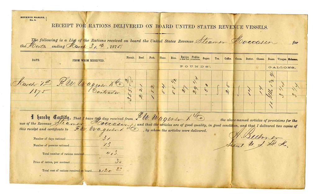
27383. [document]
U. S.
Revenue Marine [Cutter Service], Form #8, RECEIPT FOR RATIONS DELIVERED
ON BOARD UNITED STATES REVENUE STEAMER MOCCASIN . c.1875.
Full 8 ½” x 14” form sheet, printed both sides is filled out for
rations for the US Revenue Steamer Moccasin for the month ending March
31st, 1875. Form lists the various rations and amounts delivered for 13
persons for 31 days. Form is signed by Lieutenant A. Beemer when
the supplies were received. Form is printed, and then filled out in ink.
Form is clean, light overall browning and to original folds. Rare early
Revenue Cutter document. (VG-). $78.
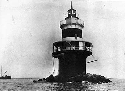 Pecks Ledge Light Sta.,
US Coast Guard photo
25320a,b,c. (lot
three disciplinary letters) Keeper Conrad Hawk, Pecks Ledge Light Station
c.1913. A lighthouse was proposed in 1896 to mark Pecks Ledge
at the east end of the Norwalk Islands in Norwalk, Connecticut but it
wasn't until 1906 that the light was operational. The lighthouse was of a
common caisson “sparkplug” type, made of cast iron plates and fitted
to accommodate two keepers. The lantern was initially fitted with a fourth
order Fresnel lens and exhibiting a flashing white light. The interior had
three stories of living space, topped by a watchroom and lantern. There
was also a basement containing cisterns for the storage of rainwater. In
February 1913, Keeper Conrad Hawk was working on his lobster traps and
left a receptacle of tar near the firebox side of the kitchen stove.
Jeremy D’Entremont notes in his’ history of the station that
”…Keeper Hawk then noticed that the nearby lantern at Grassy Hummock
was out and rowed over to relight the navigational aid. On his way back to
Pecks Ledge he saw smoke pouring from the windows in his light tower.
Thinking quickly, Keeper Hawk climbed to the tower roof and managed to get
inside the lighthouse. He blocked a kitchen window with a quilt, stopping
the draft that was feeding the fire. He then repeatedly drew seawater with
a bucket and managed to put out the flames”. Although his carelessness
caused the fire, the keeper's fast thinking may have saved the lighthouse
from destruction. However, considerable damage was suffered by the
station. Offered here are the three official specification of charges and
disciplinary letters issued by the Bureau of Lighthouses with one signed
in the hand of Commissioner George Putnam.
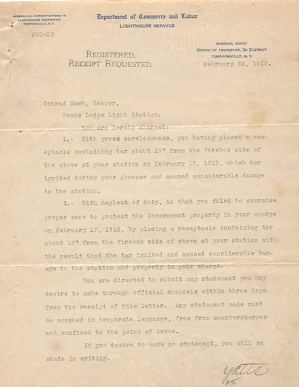
The
first letter, dated February 25, 1913 details two charges against the
keeper and details the fire incident. It further directs Keeper Hawk to
reply with any statement that he wished to make. Signed by J. Y. Yates,
Office of Lighthouse Inspector, 3rd District, Tompkinsville, N.Y.
The
second letter, (not shown) dated February 26, 1913 notes that
“…while it is considered that the fire was a result of carelessness on
your part, this office is gratified to know that upon discovering the
fire, you without assistance, used all available means at your command to
extinguish the fire until it was out.” Signed by J. Y. Yates,
Office of Lighthouse Inspector, 3rd District, Tompkinsville, N.Y.
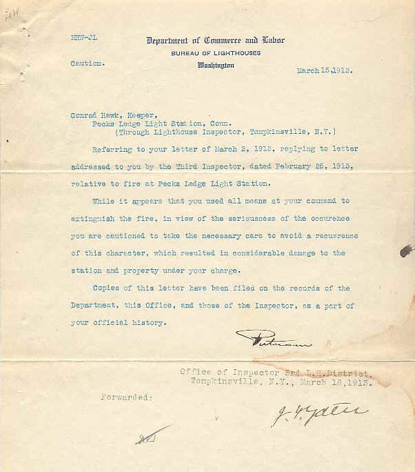
The
third letter, dated March 15, 1913 is from the Bureau of Lighthouses,
Washington and is signed in the curse hand of Commissioner George
Putnam. Putnam notes that although the keeper used all available means
to extinguish the fire, in view of the seriousness of the incident he was
cautioned to avoid a reoccurrence, and notes that copies of the letter
have been filed in the keeper’s personnel file.
In
view of the seriousness of the incident, it is extremely rare in my view
for the Lighthouse Service to have retained the keeper whereas in prior
years, far smaller infractions had resulted in more serious consequences
including dismissal. This three letter lot on such a subject, including
one letter from the Commissioner himself, in original and in such
good condition, is an unprecedented find.
Documents
measure 8” x 10 ½” and are on original printed stationery of the
Lighthouse Service (two different styles). Documents are overall bright
and clean, only light foxing or soiling and one stain. Each with two
original folds. (VG+).
Lot three (3) documents $785 net.
25330. (document) U.
S. Lighthouse Service, Superintendent of Lighthouses, 3rd District,
Thompkinsville Lighthouse Depot, New York. May 11, 1921. 4p.
Original proposal / order signed by F. W. Ockenfels, 1st Assistant
Superintendent, requests 144 fishing lines, 150 feet in length , from
the Hall Rod Works in Highland Mills, New York. Typed LHS form No. 110
includes complete specifications for same. Nice example of early
Lighthouse Service documentation. Only light use. (VG). $64.
Decorate
Your Wall With An Original Vintage Nautical Chart Of Your Favorite New
England
Coastal Area:
We have discovered a wonderful selection of
vintage c. 1919-1943 U.S.G.S. coastal navigation charts covering
Maine
,
New Hampshire
,
Massachusetts
and parts of
Rhode Island
. These charts are quite large and are generally unused, most with only
two original folds. They are clean and bright and would be a perfect
choice for framing to mount on your wall. As expected, each includes
excellent detail of Coast Guard stations, coastal navigational aids
including lighthouses, lightships, and much more. All in VG or better
condition, no marks unless noted. We have 32 charts available, half of
which are shown here. Please email for complete listing. A-139
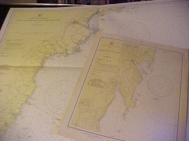
A-139
1.
Quoddy Roads to Petit Manan Is. 1941 (42 ½ X 32 ½).
Grand Manan Island
, etc. $24.
5.
Cross Is. To Nash Is. 1943 (41 x 29) Nash Is. Lt., Moose Peak Lt., Libby
Is., Avery Rock Lt. Shows many islands and details of shoreline, etc.
$24.
6.
Nash to Schoodic Is. 1939 (27 ½ x 41) Shows Columbia Falls, Addison,
Harrington, Cherryfield, Millbridge, including Prospect
Harbor light, Nash Is., Petit Manan Is., etc. $24.
8.
Blue
Hill
Bay
1943 (27 1/2X 42 ½).
Mt.
Desert
Island
, western part, etc. $28.
10.
Moose Cove to
Englishman
Bay
1919 (41 X 29 ½)./
Machias
Bay
,
Cross
Island
, etc. $24.
13. Deer
Is. Thoroughfare & Casco Passage 1938 (35 x 22) Mark Is.,
Stonington
, Parts of Swans Is., etc. $24.
All districts available, please inquire.........
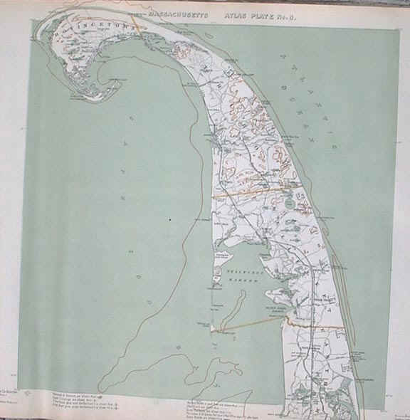
6744a,k. [Topographic Map]. CAPE COD FROM
PROVINCETOWN TO EASTHAM INCLUDING TRURO, WELLFLEET AND EASTHAM.
Walker Lithographers & Publishers, Boston. c.1900. Size 20"h x
28 ½".From early Atlas of Massachusetts. Beautiful, early, three
color topographic maps show the important contours and features of the
area including the Lighthouses and Life-Saving Stations, light vessels,
as well as roads and important town buildings, etc. This map includes
the complete towns of Provincetown, Truro, Wellfleet and MUCH OF
Eastham. U. S. Life-Saving Stations include Race Point, Peaked Hill Bar,
High Head, Highland, Pamet River, Cahoon Hollow and Nauset. Lighthouses
include Long Point, Wood End, Race Point, Highland, Nauset Beach Lights,
Mayo’s Beach Light and Billingsgate. Also includes Marconi Wireless
Station, all roads, railway lines, shoals and bars, and much more. Map
is quite desirable for framing and is new old stock. Unusually clean and
crisp save, never used. These early coastal maps are most desirable for
display and bring a premium, particularly on the Cape and the islands.
(VG+). $118 net.
Other Cape areas available - please inquire.
Wig-Wam Point
Light-House
, Gloucester, Mass.
Rare,
Early, Letterpress Copies of Hand-Written Letters from the Secretary of
the Treasury regarding Keeper Appointments, Dismissals, and other
Business of the Day. 1840’s
Letterpress
copy was a method in use fairly early in the neneteemth century for
producing one file copy of a hand-written ink document; Thomas Jefferson
made extensive use of it. The process involved dampening the surface of
a freshly written original letter of document, placing over it a thin
sheet of paper, and pressing this sandwich in a special press. Enough
ink from the original would be absorbed by the thin paper for a copy of
the letter to be made. It was possible to produce an excellent reference
copy using this method. Signatures as well as the text are transferred
in this method, producing one copy that is difficult to distinguish from
the original. Since only one copy can be produced from an original using
this method, one can be fairly certain that no other copies and possibly
not even some of the originals exist today.
Wig-Wam
Point
Light-House
, Gloucester, Mass. November 11, 1841.
Rare letter regarding appointment
of the Light Keeper: [document - letterpress copy. 8” x 11”. 1
page.]. “[to] Hon. L. Saltonstall, Salem, Mass. November 11, 1841.
Sir:
I have to acknowledge the receipt this day, of your letter of the
8th inst with enclosures of papers favorable to the appointment of Mr.
Lane as Keeper of Wig – Wam Point Light House, Mass.; all of which
shall receive my most respectful consideration when a change is deemed
expedient. Very respectfully,
Your Obt Servent, [signed] W [Walter J] Forward. Secy of the Trea.”
#6385. $185.
Also:

24323a.
(Lot: document & photo) Keeper C. L.
Knight, Goose Rocks Light Station, Maine c.1930. Charles.L.
Knight was a lighthouse keeper on the Maine coast for over 30 years. His
assignments included Goose Rocks LH, Hendricks Head LH and others.
Included here is an original Form 76 filled out by Keeper Knight,
Department of Commerce Lighthouse Service, Shore Liberty or Leave
of Absence of Keepers dated October 30, 1930. The form is a
request for a four day shore leave from Goose Rocks light station, to
visit his family. Form is typed and signed in the hand of Keeper Knight,
as well as initialed in approval by the Superintendent, First Lighthouse
District. 8” x 10 ½”. A
fine lot, perfect for your collection of framing. (VG).
$248.
-
-
-
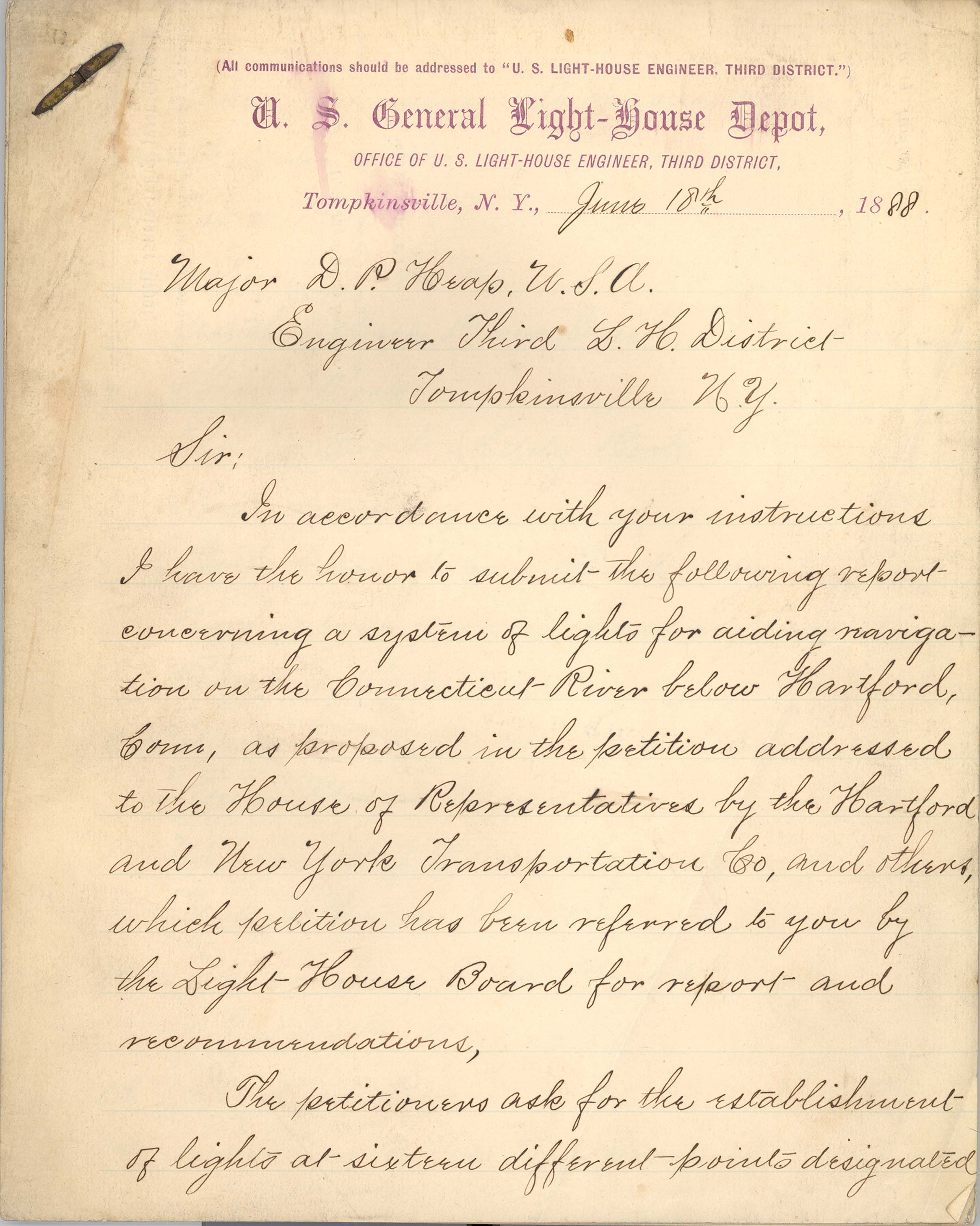
24130. [document] United
States General Light-House Depot. By John Millis, 1st.
Lieut of Engineers. To Major D. P. Heap, Engineer, 3rd. Light House
District, U.S. General Light House Depot, Thompkinsville, NY. Dated
June 18, 1888 on stationery of the U.S. General Light House Depot,
Thompkinsville
,
NY
. Twenty two page manuscript on original stationery from John Millis,
1st. Lieut of Engineers to his superior Major D. P. Heap, Engineer,
3rd. Light House District concerns a proposed system of 16
navigational lights for the Connecticut River below
Hartford
and is based upon Millis’ personal observation of river traffic and
topographical considerations. Report is in response to a request by
the Light House Board and includes his recommendations. Lights
considered and discussed include: Essex Reef, Joshua Rocks, Deep
River, Chester Rock, Eddy Rock, Rock Landing, Scovil’s Rock, Radsrn
Rock, Bodkin Rock,
Lower
Mousr
Island
,
Upper
Mousr
Island
, Pistol Point, Dividend Pier, Two Piers Channel,
Nauboc
Range
, and Colts Pier. In various cases lighthouses were proposed and later
constructed, or other aids were added. Superb manuscript, all on rare
original General Light House letter sheets, intact, clean save a few
edge stains. (VG-). $395 net.
U.S.
LIGHTHOUSE SERVICE - Original
Architectural Drawings c. 1909 - 1939.
I
have been very fortunate to come across this lot of thirteen original
architectural drawings for light stations and depots in the Sixth and
Seventh LH Districts. It is exceptionally rare to find a lot of such
fine material and with so many pieces relating to individual light
stations. These one of a kind, original hand drawn ink on linen
architectural drawings are excellent for research or display and
provide a rare opportunity to obtain such marked Lighthouse Service
pieces at an affordable price. One or multi-colored and quite nice for
framing for display.

24194a. Office of Superintendent of Lighthouses, Sixth District,
Charleston
,
SC.
Ward’s Bank Rear Range Light Station Substructure. March 14, 1932.
11” x 16” Ink on Linen. $85.
24194b.
Office of Superintendent of Lighthouses, Sixth District,
Charleston
,
SC.
Balance Wheel for 1st Order Clockwork. Approved February 25,
1919. ” Ink on Linen. $75.
24194c.
Office of Superintendent of Lighthouses, Sixth District,
Charleston
,
SC.
Accumulator Rack. Ink on Linen. $75.
24194d.
Office of Superintendent of Lighthouses, Sixth District,
Charleston
,
SC.
Cast Iron Hub for Driven Wheel for 8 Inch Screw Pile. Scale 3” –
1’ 0”. February 10, 1939. Ink on Linen. $65.
24194e.
Office of Superintendent of Lighthouses, Sixth District,
Charleston
,
SC.
Pedestal for Light Station 55 mm [mantle diameter] [IOV] Lamp – Type
A – Type B. Scale 3” = 1’ March 7, 1918. 21” x 24”.
Ink on Linen. $225.
24194f.
Office of Superintendent of Lighthouses, Sixth District,
Charleston
,
SC.
14” Square Reinforced Concrete Pile. Scale 1” = 1’. May 22,
1913. 17” x 11”. Ink on Linen. $55.
24194g.
Office of Superintendent of Lighthouses, Sixth District,
Charleston
,
SC.
10-Foot Skeleton Pipe Tower for Front Range Light. March 26,
1919. Ink on Linen. $165.
24194h.
Office of Superintendent of Lighthouses, Sixth District,
Charleston
,
SC.
St. John River Light House. Stand for 3 I.E. [Incandescent Electric ]
Lamps. Scale 1 ½” = 1”. July 28, 1928. 10 ½” x 15 ½”. Ink
on Linen. $85.
24194i.
Office of Superintendent of Lighthouses, Sixth District,
Charleston
,
SC.
Reservations St. Simon Light
Station
,
Georgia
. Scale 1” = 100’. May 22, 1909. 11” x 18”. Ink on Linen.
$85.
24194k.
Office of Superintendent of Lighthouses, Seventh District, Key West,
FL. Working Platform for Triangular Iron Pile Structure with Wooden
Superstructure. Scale 3/8” = 1’. March 16, 1925. 11” x 16”.
Ink on Linen. $65.
24194L.
Office of Superintendent of Lighthouses, Sixth District,
Charleston
,
SC.
Site of Arlington Cut Range Rear Light. Scale 1” = 100’. December
15, 1922. 10” x 16”. Ink on Linen. $45.
24194m.
Office of Superintendent of Lighthouses, Sixth District,
Charleston
,
SC.
Charleston Light House Depot Concrete Pile Encasement. Scale 1/2”
= 1’. May 24, 1932. 10” x 15”. Ink on Linen. $35.
Official
US
Lighthouse Service Forms and Documents
Here is a wonderful selection of
official Department of Commerce,
US
Lighthouse Service, forms and documents. Forms are printed originals,
unused and remain clean and crisp, perfect for framing.
D-09-2.
US
Lighthouse Service, Department of Commerce, Form 95 for a
"Requisition For Articles". The form was to be filled
out and sent in for lighthouse keepers, masters of vessels such as
lightship and lighthouse tender's to requisition supplies of any kind.
8" X 10.5". $44.
D-09-3.
US
Lighthouse Service, Department of Commerce, Form 4 for a
"Abstract of Obligations"…"To be paid direct by
the Bureau of Lighthouses" [Basically an expense report for
Lighthouse Service personnel]. 8" X 10.5". Used with the
Airways Division of the Lighthouse Service. $32.
D-09-4.
US
Lighthouse Service, Department of Commerce, Form 45 for a
"Construction Weekly Progress Report". This form was
used with the Lighthouse Service Airways Division. It was to be filled
out and sent to the Inspector of Airways Construction. 8" X
10.5". $44.
D-09-5.
US
Lighthouse Service, official business envelope. This envelope is
pre-addressed to the Superintendent of Lighthouses in
Portland
,
Oregon
. This is a typical #10 size envelope which measures approximately
4.25" X 9.5". $26.
D-09-6.
US
Lighthouse Service, Department of Commerce, Form 33 for a
"Standard Government Short Form Contract". The form was
to be filled out and sent out for companies bidding on government work
with the Lighthouse Service. 8" X 10.5". $12.
D-09-7.
US
Lighthouse Service, Department of Commerce, Form 105a for a
"Field License". The form was to be filled out and sent
in for emergency landing fields, beacon lights and other lighting
equipment for guiding and landing aircraft. 8" X 14". This
form was probably used with the Airways Division of the Lighthouse
Service. $24
D-09-8. US Lighthouse
Service, Department of Commerce, Form 1012 for a " Public Voucher
for Reimbursement of Travel and Other Expenses Including Per Diem
". $12
Note.
The Air Commerce Act of 1926, provided for the encouragement and use
of aircraft in commerce, under the Secretary of Commerce. The Airways
Division was set up as a part of the Lighthouse Service, and F.C.
Hingsburg was appointed Chief Engineer, Airways Division. Mr.
Hingsburg was previously Superintendent of Lighthouses on general
duty, and had been connected with the Lighthouse Service since 1911.
6744i. [Topographic Map]. CAPE COD FROM TRURO
TO BREWSTER INCLUDING ORLEANS, EASTHAM AND WELLFLEET. U.S.
Geological Survey. September 1893 edition, reprinted 1923, from surveys
done in 1887. Size 16 ½"w x 20"h. The scale of the map is
1:62,500, with contour lines at 20-foot intervals. Beautiful, early,
three color topographic maps show the important contours and features of
the area including the Lighthouses and Life-Saving Stations, as well as
roads and important town buildings, etc. This map includes the complete
towns of Orleans, Wellfleet, Eastham, part of Brewster and Truro. U. S.
Life-Saving Stations include Pamet River, Cahoon’s Hollow, Nauset, and
Orleans. Lighthouses include Billingsgate, Mayo’s Beach, Nauset Beach
Beacons. Also includes all roads, railway lines, shoals and bars, and
much more. Map is quite desirable for framing and is clean and crisp as
original. Unusually clean and crisp, would be wonderful framed. These
early coastal maps are most desirable for display and bring a premium,
particularly on the Cape and the islands. (VG+). $138 net.
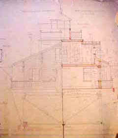
U.S.
LIGHTHOUSE ESTABLISHMENT. Original hand drawn architectural drawings for
a: Screw Pile Light House for 4th, 5th, and 6th Order Lenses [square
style]. Engineer
Secretary, U. S. Light House Board. 1880-1896
We have been very fortunate to come across
a large lot of original U. S. Light House Establishment architectural
drawings for the construction of various lighthouses, keeper’s
dwellings, oil houses, range beacons and more This lot originated from
the Lighthouse Establishment Engineering Offices and includes many one
of a kind items. This portion includes 15 drawings for a Screw Pile
Light House for 4th, 5th, and 6th Order Lenses. Screw Pile Type
lighthouses represented in this lot include: Neuse River Light House,
Long Shoal Light House, Croatan Light House, Lower Cedar Point, MD.,
Holland’s Island Bay, MD., & Great Wicomico River, VA. Light
Houses. There were two basic styles of screw-pile lighthouses – square
and octagonal. Most lighthouses of each shape were from the same basic
plan, in fact many plan sheets have multiple lighthouse names on them
and they were reused over the years. All drawings are hand drawn, ink on
paper and are done in from one to three colors each. These original hand
drawn in ink architectural drawings represent an unprecedented view into
the design and construction of this style of lighthouse. The drawings
are quite beautiful and would be wonderful for research or to frame for
display. Condition varies but as you might expect being early paper, the
edges on many have chipping and some small tears. Many have been tape
reinforced. Fifteen superb architectural views include: Elevation
Views: Full elevation view labeled Lower Cedar Point, MD. c.1896.
3-color. 25" x 38". Screw Pile Section and Soundings, Corner
Steel Castings, Repair of Substructure… Lower Cedar Point Light House,
MD. c.1906. Half Sectional Elevation of First Floor & Part of Second
Floor, Roof & Drum. Holland’s Island Bay, MD., & Great
Wicomico River, VA. Light Houses. c.1889. [following labeled]
"Screw Pile Light House for 4th, 5th, and 6th Order Lenses":
Sheet #4 Plan for 2nd Floor. 22" x 32" hand drawn, ink on
paper. b/w. Sheet #5 Details of House Frame. 22" x 32" hand
drawn, ink on paper. b/w. Sheet #6 Lantern Deck, Watch Room Deck, Roof
Frame. 22" x 32" hand drawn, ink on paper. b/w. Sheet #7
Details of Wood Work. 22" x 32" hand drawn, ink on paper. b/w.
Sheet #8 Details of Wood Work. 22" x 32" hand drawn, ink on
paper. b/w. Sheet #9 Details of Wood Work. 22" x 32" hand
drawn, ink on paper. b/w. Sheet #10 Details of Gable End. 22" x
32" hand drawn, ink on paper. b/w. Sheet #11 Details of Iron Work.
22" x 32" hand drawn, ink on paper. b/w. Sheet #12Details of
Iron Work. 22" x 32" hand drawn, ink on paper. b/w. Sheet #13
Details of Iron Work. 22" x 32" hand drawn, ink on paper. b/w.
Sheet #14 Details of Iron Work. 22" x 32" hand drawn, ink on
paper. b/w. Sheet #17 Details of Metal Work. 22" x 32" hand
drawn, ink on paper. b/w.
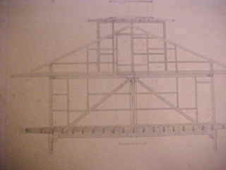
#S-01. Set 15 original
drawings $3,995 net
22523. [Parliamentary Paper] REPORT
OF THE TRINITY BOARD CORPORATION ON ALL EXPERIMENTS MADE WITH A VIEW OF
TESTING THE DIFFERENT PLANS FOR FOG SIGNALS….. House of Commons. March
14, 1864. 10 p. A consideration of the merits of various
types of fog signals with testimony and results of experiments
presented. Includes comparisons of various trumpets, guns, and of
particular interest is Daboll’s horn. Comparison tables of results of
the various fog signal devices are included. Excellent for research on
the subject. Disbound folio 8" x 13". (VG). $22.
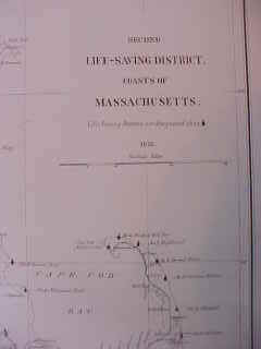
[map copy]. United States
Life Saving Service. SECOND LIFE SAVING
DISTRICT. COAST OF MASSACHUSETTS. 1876. Large 14 ¾" x
26" map shows the 14 life-saving stations that existed at the time
along the mainland coast and on Nantucket. Stations are nicely marked
with a silhouette of an early station style with the appropriate station
number noted. Map details the coastline nicely as well as the major
railroad lines at the time. Scale 1" = 5 nautical miles. Map is
from the original, issued by the U.S. Life Saving Service in 1876 and
would be quite desirable for reference or for framing.
Available in two forms:
C95111A. 20 lb. Black on
white bond paper 14 ¾" x 26". Ideal for reference. $18.
C95111B. 24 lb. White semi
gloss paper, in color showing brown background as original. Ideal for
framing or reference. $24.95.
LIGHTHOUSE
ARCHITECTURAL PLANS
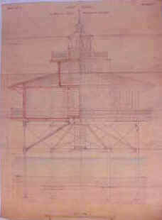
We have been very fortunate
to come across a lot of ten original c.1858 architectural drawings and
contract document for the construction of the screw-pile type
lighthouses at the Cherrystone Inlet,
Chesapeake Bay, Virginia and at Stingray Point, Chesapeake Bay, Maryland.
This lot originated from the family archives of Captain Lorenzo
Sitgreaves (1811-1888), of the United States Topographical Engineers,
who was closely involved in the design and construction of many
lighthouses throughout the country. This lot includes one-of-a-kind
items including the original contract documents and nine original full
color hand drawn in ink on linen architectural drawings. These represent
an unprecedented view into the design and construction of these early
lighthouses. The drawings are quite beautiful and would be wonderful for
research or to frame for display.
Please inquire for more
details.
21377. [document copy] U. S. Department of
Commerce, Lighthouse Service, Keeper’s Annual Property Return,
Requisition, and Receipt Form No. 30. 24 pages. 8" x
10". Lengthy form contains spaces for all items needed by the
Keeper and is would be filled out in his hand indicating the quantity of
each item on hand, received, and used during the year. Each and every
possible item is noted, from all sizes of brushes, to boats, burners,
lamps, wicks, tools, deflectors, furniture, dinnerware, lamp fittings,
paint, books and forms, and much more. Listing covers 24 pages and is a
must for researchers working to properly furnish your lighthouse or
museum exhibit. Quality photocopy, spiral bound. $8.
20511-20. [document] This is a
1-page voucher from the files of Light-House Inspector L. Sitgreaves,
for the Eleventh Light-House District. Dated 9 November 1854.
Payment voucher lists repairs performed on the Waukegan [Harbor, Racine,
Wisconsin] Lighthouse during the period March until August 24, 1854 and
authorizes payment of $120.45. Some of the work on the lighthouse
detailed includes; stovepipe for lighthouse tower, padlock, cordwood,
chimneys for lamps, masonry work, materials for staging and repairs
detailed, labor for fitting zinc on deck, and more. Document is filled
out on official Light-House Establishment form in the hand of Capt.
Sitgreaves and is signed by him. Capt. Sitgreaves was Light-House
Inspector in the Eleventh District, and designed and built a number of
light stations in his long career. This document is part of an important
lot of early documents of the period just after the complete
reorganization of the Light-House Establishment and institution of the
new Light-House Board. During this point many lighthouses were repaired
and many new stations established. Document measures 8" x 12",
two sides, with 3 original light folds, extremely clean, crisp. A most
interesting and scarce early Great Lakes.
20511-99.
[document] This is a 1--page hand written document from the files of
Light-House Inspector L. Sitgreaves, for the Eleventh Light-House
District. Dated December 7, 1854. Hand written receipt acknowledges
payment to J. E. Southerland for repair of lighthouses in the Eleventh
Light-House District [
Great Lakes
]. Work included supplying lights with hickory firewood, 2 pair
scissors, padlock for beacon, whitewashing the light, and more. Document
is hand written and signed by the recipient on blue lined paper and
originated in files of Capt. Sitgreaves. Capt. Sitgreaves was
Light-House Inspector in the Eleventh District, and designed and built a
number of light stations in his long career. This document is part of an
important lot of early documents of the period just after the complete
reorganization of the Light-House Establishment and institution of the
new Light-House Board. During this point many lighthouses were repaired
and many new stations established. Document measures 8” x 10, one
side, with original light folds, overall clean, crisp. A most
interesting and scarce early
Great Lakes
lighthouse document. (VG). $42
20511-35.
[document] This is a ½--page hand written document from the files of
Light-House Inspector L. Sitgreaves, for the Eleventh Light-House
District. Dated May 12, 1854. Hand written receipt acknowledges payment
to John O’Connor for repair of the light keeper’s boat at the Tail
Point Light-House in
Wisconsin
[now known as Long Tail Point]. Document is hand written and signed by
the recipient on blue lined paper and originated in files of Capt.
Sitgreaves. Capt. Sitgreaves was Light-House Inspector in the Eleventh
District, and designed and built a number of light stations in his long
career. This document is part of an important lot of early documents of
the period just after the complete reorganization of the Light-House
Establishment and institution of the new Light-House Board. During this
point many lighthouses were repaired and many new stations established.
Document measures 6 ½” x 5”, one side, with original light folds,
overall clean, crisp. A most interesting and scarce early
Great Lakes
lighthouse document. (VG). $42
Other similar documents available for the following
locations… Pricing $35 - $110. Please inquire.
|
Lighthouse
repair/construction/moving:
2-
Round Island [
Lake Superior
]
3
- Ottawa Point [name changed to
Tawas Point
,
MI
]
Bailey’s
Harbor, WI.
2
-
Twin
Rivers
, Wisc. [now known as
Two Rivers
,
WI
.
2
- Waukegan Lighthouse [also
Waukegan
Harbor
]
Waukegan
Little Fort Light [now known as
Waukegan
Harbor
]
2
-
Tail Point
,
WI
[now known as Long Tail Point
Sheboygan
[WI ?]
Gale
Point
LH
, …Bay [?]
2
- Milwaukewe LH & Move to
North Point
,
WI
.
4
- LH at mouth of
Clinton
River
[Port Clinton, OH ?]
Belvidere
LH {?]
Beacon
@ Milwaukee WI
2
–
Port Washington
,
WI
|
2
–
Michigan
City LH, IN
Saginaw,
St Mary’s,
Eagle
River
& more
Thunder
Bay LH
Muskegan
LH
2
– White Fish Point,
Lake Superior
LH
@ Mouth of
Milwaukee Bay
,
WI
Little
Fort
LH
&
Waukegan
,
IL
.
Ontonajou
LH [
Ontonagon
,
MI
?]
LH
@ Grand Haven & Muskegon
Manatouac
Michigan City
Grand
Haven Lt
Buoys
repair, etc: St Clair Flats, Point Huron, 4 - Fox River [
Neenak
River
], 2 -
Saginaw
Bay
|
U. S. Lighthouse
Establishment
Office Light
House Inspector, 4th Dist., Philadelphia.
Official
Correspondence - 1889
Correspondence
is on official Treasury Department, Office of the Light-House Board
letterhead, signed, and bears official District Office of the
Light-House Inspector stamp.
657. From James
Gregory, Engineer Secretary to Comdr. J.J. Reed, Inspector 4th. L. H.
District, acknowledging receipt of communication showing the amount of
hours fog-signals were in use during the year ending 30 June, ‘89.
Dated August 20, 1889. $20.

6184. [example
shown] From James Gregory, Major of Engineers to Comdr J. J. Reed,
Inspector 4th Light-House District enclosing vouchers for repairs to the
L. H. Tender Geranium. Dated June 25, 1889. $18
659. From James
Gregory, Engineer Secretary to Comdr. J.J. Reed, Inspector 4th. L. H.
District. Acknowledging receipt of Report of Operations for July.
Dated August 26, 1889. $18.
674. From Commander
George Coffin to Comdr. J. J. Reed, Inspector 4th Light-House District
regarding damages to Light-House property. Dated September 13,
1889. $18.
671. From James
Gregory, Major of Engineers to Comdr J. J. Reed, Inspector 4th
Light-House District forwarding contracts with Messrs. Darrah &
Elwell for furnishing provisions for 1889-90. Dated June 26, 1889.
$16.
6183. From James
Gregory, Major of Engineers to Comdr J. J. Reed, Inspector 4th
Light-House District returning proposals for paint for buoyage purposes.
Dated August 15, 1889. $14.
6186. From
Commander George Coffin to Comdr. J. J. Reed, Inspector 4th Light-House
District acknowledging receipt of inventory for light-vessels and
tenders. Dated October 19, 1889. $16.
6188. From
Commander George Coffin to Comdr. J. J. Reed, Inspector 4th Light-House
District transmitting Report of Operations for September 1889.
Dated October 17, 1889. $18.
6189. From James
Gregory, Major of Engineers to Comdr J. J. Reed, Inspector 4th
Light-House District requesting information regarding fog signal
operations, equipment in use, hours of operation and amount of coal used.
Dated August 16, 1889. $18.
U. S. Lighthouse
Establishment
Original
Reply
Letters
Official Treasury Department, Office of the
Light-House Board, Form No. 126
acknowledging the receipt of various monthly supply and equipment forms,
reports, statements and returns. These originated from the
correspondence file, District Inspector, Fourth Light-House District.
All bear official letterhead, are stamped with official Light House
Inspector’s stamp and dated and many are signed (*) by George W.
Coffin, Naval secretary. Many contain reference to L. H. Tenders or
other items of interest.
This is a fine opportunity to obtain nice examples of
an official document at an affordable price.
Quite frameable, 8" x 10½", slight browning
from age but overall good condition, tape remnants one edge.
6190. From George W. Coffin,
Naval Secretary to Comdr. J.J. Reed, Inspector 4th. L. H. District,
acknowledging receipt of reports of statements and balances.
Dated October 14, 1889. $17.
6207. From George W. Coffin,
Naval Secretary to Comdr. J.J. Reed, Inspector 4th. L. H. District,
acknowledging receipt of reports of inspection of light-houses.
Dated October 25, 1889. $17.
6210. From George W. Coffin,
Naval Secretary to Comdr. J.J. Reed, Inspector 4th. L. H. District,
acknowledging receipt of reports of inspection of light-houses.
Dated October 29, 1889. $17.
6225. From George W. Coffin,
Naval Secretary to Comdr. J.J. Reed, Inspector 4th. L. H. District,
acknowledging receipt of reports of inventory of the Light Vessel No.
37. Dated October 31, 1889. $19.
U. S. Lighthouse
Establishment
Original Letters
of Receipt
Official
Treasury Department, Office of the Light-House Board, handwritten
communications on Official Stationary Form No. 127.
These originated from the correspondence file, District Inspector,
Fourth Light-House District. All bear official letterhead, are
stamped with official Light House Inspector’s stamp and dated and many
are signed by George W. Coffin, Naval secretary. Quite
interesting, containing various items regarding Light-Vessels, L. H.
Tenders, construction projects, keepers, supplies, budgets or other
items of interest.
This is a fine
opportunity to obtain nice examples of official documents at an
affordible price. Quite framable. 8" x 10½", slight browning
from age but overall good condition.
6221. From Commander George Coffin
to Comdr. J. J. Reed, Inspector 4th Light-House District advising of
receipt of Report of Operations for October. Dated November 5,
1889. $16.

6217. From Commander George Coffin
to Comdr. J. J. Reed, Inspector 4th Light-House District advising of
receipt of communication relating to Signal Service, or Life Saving
Stations near Light-House Reservations. Dated November 6, 1889. $18.
6216. From Commander George Coffin
to Comdr. J. J. Reed, Inspector 4th Light-House District advising of
receipt of communication relating to the characteristic of the fog
signal at Fort Mifflin, Pa. Dated October 4, 1889. $18.
6215. From Commander George Coffin
to Comdr. J. J. Reed, Inspector 4th Light-House District advising of
receipt of communication and copy of letter from the U. S. Attorney
relative to claim of ‘Viola’. Dated October 22, 1889. $18.
6177. From Commander George Coffin
to Comdr. J. J. Reed, Inspector 4th Light-House District advising of
receipt of communication requesting copies of the International Code.
Dated September 19, 1889. $18.
6194. From Commander George Coffin
to Comdr. J. J. Reed, Inspector 4th Light-House District advising of
receipt of communication transmitting a record of ocean temperature as
observed at Absecon, N.J. Light-Station. Dated October 5, 1889.
$16.
More Documents....
7239. NOTICE TO MARINERS. Light
Discontinued. "Treasury Department, Office Light-House
Board,...October 5, 1859."…The Light-House Board, at its meeting…recommended
that the following light be discontinued, viz: The light at New Haven
long wharf, (Conn.)….on November next….By order of the Secretary of
the Treasury: R. Semmes, Secretary." Slight moisture stain, folded
but most presentable. 8"w x 10"h. Matted for framing. (VG-)
$195.
Rare, Early, Original Hand-Written Letters from the
Secretary of the Treasury regarding Keeper Appointments, Dismissals, and
other Business of the Day.
1840’s
Light-House at Eagle Island
(Maine). January 31, 1848.
Rare letter regarding the appointment of the Keeper:
[document - original. 7 ½" x 8".
1 page.].
"[to Hon. E. K. Smart, House. of Reps.
Treasury Department.
31 Jany. 1848
Sir:
I have the honor to acknowledge the receipt
of your letter of this date transmitting the recommendation of James
Wyman (sp) and others in favor of the appointment of William W. Laughlin
as Keeper of the Eagle Island Light and to inform you that it shall have
respectful consideration.
I am respy.
[initialed] W.C.Y. [McClintock Young]
Actg. Secy Tr[easury]."
#6379. $158. net.
Rare, Early, Letterpress Copies of Hand-Written
Letters
Rare letter regarding the appointment of the Keeper:
[document - letterpress copy. 8" x
11". 1 page.].
"[to Hon.... Francis Granger...
House of Rep’s.
June 30, 1842.
Sir:
Your letter without date enclosing a
petition in favor of Capt. Eadur(sp) for keeper of Big Sodus Light House
was received this morning and shall be placed upon the files of the
Department. The appointment for Sodus Bay Light was made on the 22nd
inst.
I am respectfully
your Obd. Servent.
[signed] McClintock Young
Secry. of Treasury
#6395. $84.
Procedure
to order items:
1. I suggest that you call us or
email to check on availability of any item that you would like other than
recent books. As items go quite quickly, please call and leave a message to
reserve items that you would like. I will return your call, hold the items and
await your letter or credit card information. We will also weigh the items and
advise postage.
2. You may then call or email credit
card information, or forward a check in the mail.
Most items are mailed US Priority Mail
or UPS. Additional information on our "Ordering Page".
Massachusetts residents must add 6.25% sales tax.
Can't find what you are looking for?
We can
help you find that needed book or item.
mailto:[email protected]
How to reach us:
Kenrick A. Claflin & Son Nautical Antiques
1227 Pleasant Street, Worcester, MA 01602
Phone (508) 792-6627
All
text and illustrations on web site Ó
James W. Claflin . 03/17/2022
All rights
reserved. Use prohibited without written permission.
Page last updated 03/17/2022
.


 Pecks Ledge Light Sta.,
US Coast Guard photo


